Andrew Millham takes us through Canvey Wick nature reserve to the seawall, showcasing the mesmerising mosaic of urban structures and bucolic rurality
Overcast. Windy. Rainy. By all accounts a stay-at-home pyjama day, but not for me. I set out mid-morning with my coat zipped up to my face and headed onto the island – Canvey Island. With not a person in sight, it was clear to me that Canvey Wick nature reserve lies well off the beaten track. I certainly had never been before. In one corner of the car park stands a ginormous metal dragonfly sculpture, rusted sandstone red. It is an impressive welcome.
Canvey Wick – now a Site of Special Scientific Interest (SSSI) – is an ex-industrial brownfield site acquired by The Land Trust in 2012, who now work together with RSPB and Buglife to tirelessly manage it for the wildlife that call it home (particularly the rare invertebrates). I won’t sugarcoat it, at first, I was taken aback by the brutalist steel railing that lines the start of the walk, covered in black graffiti, but I have concluded that it adds to the unique charm of the place.
Human boot and doggy paw prints were the only signs that anyone had been here all day. I had heard about an unfortunate wildfire here last summer, and now I saw the evidence. Brambles lining the puddled gravel path were scorched black like charcoal pencils, looping and drooping across the land. Green weeds had grown into the spaces between the blackened brambles, which made a striking contrast – life and death. Above, cawing crows were completely silhouetted against the pillowy white sky like characters not yet unlocked in a video game.
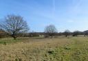
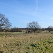
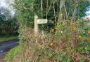
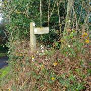
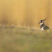
Soon the gravel path reached a crossroad, and I chose to follow the Bee Trail through the mixture of hummocky grassland and birch trees. A surprised SQUAK echoed as I turned the corner and a flying beastie of bright red, yellow and green shot up from the floor and into the birches. It was a green woodpecker, the colour of exotic spices. With this nature spectacle before me, the large industrial silos of the Coryton oil refinery watched on from the horizon and, at this point in the walk, an arrow-shaped sign pointed as if to say, ‘Seawall, this way à.’ I followed.

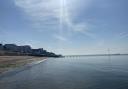
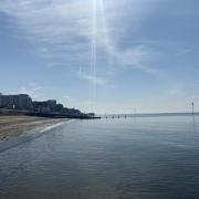
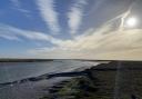
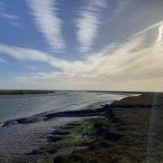
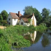
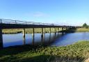
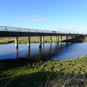
A large wharf appeared (firms.translated.guess), providing an up-close-and-personal view of the silty Holehaven Creek with the tide partially in. Two ‘horses’ are visible in the creek – the Upper and Lower horse – with the word ‘horse’ being an old local word for ‘island’ or ‘mudbank’. And yet, the riverscape is dominated by a large jetty, which looks like a railway projecting out into the Thames, almost a mile long. It was built when Occidental Petroleum were planning an oil terminal in the 1970s to allow tankers to berth in deeper waters without the fear of running aground. The terminal never materialised so the jetty is a reminder of what could have been.
By now the wind had increased, the water sloshed hard against the banks and oyster catchers flew like fighter jets across the surface. A raft of ducks (also known as a ‘team’ or a ‘paddling’) showed little concern for the squally conditions, but for me, a cosy lunch was calling. I headed to The Lobster Smack (latest.counts.splash) – a traditional white weatherboarded, wooden-beamed pub right next to the reserve. After such a quiet walk, the low rumble of chatter from the bar was welcome. Rain finally burst from the ever-swelling clouds and tapped on the window as a bowl of steaming onion rings was delivered to my table. What a fantastic day.
Distance: 1.5 miles
Time: Two hours, including time to stop, snack and stare
This column uses what3words, an easy way to identify precise locations. Every three m² on earth has its own unique combination of three words. To use, download the free app, or visit what3words.com