Explore a small village sitting quietly in the north of the county on the flanks of the Stour Valley.

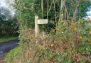
1. Towards the rear of the car park (facing the complicated-looking pylon) take the path to the right of the double wooden gates. Pass through a tall kissing gate and follow the path through the wood, with a wire fence on your left. Exit the wood via a dilapidated gate and negotiate the sliding rails to access a meadow; the path continues alongside a line of trees. After 500 metres, an open metal gate opens onto a strip of land to the rear of Fenn Farm. At the end of this turn right onto a bridleway track leading uphill and bending left, passing through the farm, to eventually emerge on Clay Hill lane, opposite a pair of semi-detached houses.
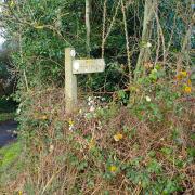
2. Turn left and in 700 metres, at the entrance to Dovehouse Farm, take the footpath across the ditch and left onto a field edge, leading uphill. Crest the hill, past a tall leylandii hedge, then towards the bottom of the downslope turn left along a footpath running parallel to the overhead power lines (a familiar sight on this walk). The path kinks up around a wooded section, eventually leading to a ‘crossroads’ with a decaying wooden horse-mounting block.

3. Turn right along a grassy bridleway then out onto a field edge, with the field on your left. Pass under the overhead wires, then past a white wooden hut, to access Church Road, Twinstead, with the churchyard on your right. Turn left and then turn right along a footpath beside Twinstead Cottage. The enclosed path leads to a wooden gate then skirts an attractive garden, onto a gravel driveway. Turn right and negotiate a metal ‘stepladder stile’ over a curved brick wall, then turn left and follow the field edge to its corner where a footbridge, nestling within the vegetation, accesses an arable field. Keep left along the field edge to reach a small woodland; the path continues within the wood, accessed by another footbridge, before returning to the field edge.

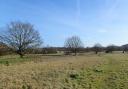
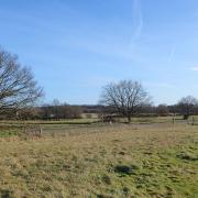
5. After a further 800 metres turn left at the entrance to Valley Farm and immediately go through a wooden gate into pasture. Head downhill into the valley to find another wooden gate leading out into a track. Turn left then go through a wooden five bar gate and pass to the right of a rather impressive blue and pink Wendy house, then the farmhouse itself, onto a grassy path leading to the bottom of the valley. After a metal gate turn left and a pair of footbridges lead to a path across a field, heading up the other side of the valley and underneath more overhead cables. At the oak tree on the other side of the field turn left and follow the path parallel to the cable, leading to a property called ‘Hickbush’. Turn left and follow a hedge, pass under the cables then turn right and cross the field, just left of a pylon; the unusual pylon back at Loshes Wood can be seen ahead. Follow the path through the meadow (also part of the nature reserve and with a very rich flora) to return to the car park.

COMPASS POINTS
DISTANCE: 5.3 miles (8.6km).
STARTING POINT: Loshes Wood nature reserve, postcode CO10 7LX, grid reference TL872370.
ACCESS: There is a gated car park at the nature reserve. This is a relatively remote area and unfortunately none of the route is accessed by public transport.
MAP: OS Explorer 196 Sudbury, Hadleigh & Dedham Vale.
REFRESHMENT: There are no pubs or shops (or toilets) on this rural route! The nearest pubs are The Fox at Bulmer Tye, The Henny Swan at Great Henny and The Lamarsh Lion (said to have been frequented by artists John Constable and Thomas Gainsborough). There are a full range of facilities at Halstead (5.5 miles to the south) or Sudbury (5.5 miles to the north).
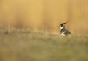
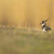
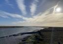
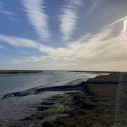
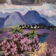
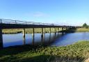
PLACES OF INTEREST: Loshes Wood and Meadow, on the walk, are worthy of attention at any time of year but especially in summer when an array of wildflowers receive the attention of a variety of butterfly species, including white-letter hairstreak. Also passed on the walk, Twinstead church is well worth a visit and something of a hidden gem. It is a very ornate Victorian building having replaced earlier structures. The River Stour, to the east, forms the boundary between Essex and Suffolk all the way from Sturmer, just east of Haverhill, to its estuary leading out into the North Sea.

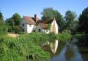
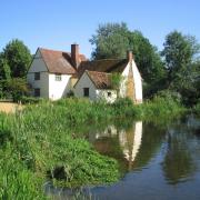
The stretch between Manningtree and Bures forms the core of the Dedham Vale Area of Outstanding National Beauty but it is difficult to understand why this ends at Bures and does not continue along the valley to include Twinstead and its surrounding area, which is every bit as beautiful and arguably more rural.
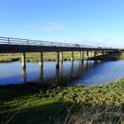
A single-track railway line – the Gainsborough line – follows the valley from Bures up to Sudbury. Although it can feel like a step back in time, this is part of the national rail network, linking with the London to Norwich mainline at Marks Tey station, having crossed the impressive Chappel Viaduct en route.
INTERACTIVE MAP: essexhighways.org/getting-around/public-rights-of-way/prow-interactive-map