Simon Taylor on behalf of the Public Rights of Way team at Essex County Council.
1. From the car park on the northern side of the road (the left side if you arrived travelling east from Wake Arms roundabout) take the wide woodland ride heading north, perpendicular to the road. There is an alternative parallel path on the left. At a junction continue straight. The path bends right in an area of hornbeam pollards. Down a shallow dip, by a low hornbeam, take the path on the left which soon leads to the ancient earthworks of Ambresbury Banks.
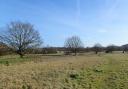
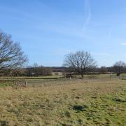
2. Ascend the bank and proceed clockwise around it. In a short while the road (B1393) becomes evident to the left and a path is visible between the bank and the road. When convenient, descend to join the path and turn right along it, keeping the road to your left as the earthworks vanishes off back into the forest. Skirt to the right of a damp, rushy area, then a patch of bracken, then a large green pond. As some buildings become visible in the distance, the path bends right. A cricket ground can be seen on the left (this famously sits atop the M25 motorway, which passes underneath in the Bell Common tunnel).
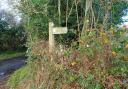
3. At a wooden post with a yellow arrow, fork right. The wide woodland ride slopes downhill, crossing two streams via earth bridges. Fork left at a junction and cross a bigger bridge with wooden rails before heading up a slope and passing a golf course on the left. On approaching the wooden fence behind some houses, turn right along the most obvious ride which, in 700 metres, leads to the ‘Genesis Slade’ car park.

4. Cross the road to access a path directly opposite, which dips down and back up before passing a large fallen trunk. At a tall beech tree with carved graffiti (including ‘BP L EZ’) turn left. Skirt a large pit and turn right on reaching a dead tree trunk approximately three metres tall, then pass a taller dead trunk with a gate visible some 25 metres off to the left. Cross a stream via a culvert beside another fallen trunk; the path undulates, and an open field can be seen through the trees to the left. After another small culvert the path heads uphill to meet a well-trodden path with two waymark arrows pointing back down the slope, and a large fallen beech. Pass a huge old coppice, which now looks like a ring of several trees, to find a low linear earthwork then turn left along this feature. With several old coppices and pollards to the left, the low feature is crossed by a larger earthwork but keep straight to pass through gaps in two groups of mature holly bushes, the second uphill from the first, to emerge onto a wide forest ride.
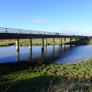
5. Turn left along the ride then, just as it begins to descend, leave to the right to pass through a gap cut in a fallen trunk, beside a large trunk with a huge bracket fungus growing on it. Head up to a ridge marked with an unusual three-trunked beech tree. Follow the ridge left then begin to descend towards a stream crossed by a pair of culverts. Cross via these then pass uphill to a holly copse, to find a well-defined track behind houses beyond. Turn right along the track then about 100 metres before the road turn right again. This path swings right towards the side of a pit then forks left. Keep the road to your left and you will see the Broadstrood car park.
6. Take the wide ride heading right, downhill from the car park. After some 600 metres, at a junction, turn left and follow the very open ride back to the starting point.
 OS Maps")
Compass Points
Distance: 4.8 miles (7.8km).
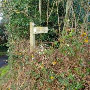
Starting point: Jacks Hill car park, off the B172 between Wake Arms roundabout and Theydon Bois (the first car park encountered if travelling east from the roundabout), postcode CM16 7DR, grid reference TQ435996.
Access: Park in the car park. There are no bus stops on this section of the B172 but the walk can be picked up from the Goldings Hill bus stop (point 6 on the map) outside Broadstrood car park on the A121, served by regular buses (66/66A) between Loughton/Debden and Waltham Cross (www.essexbus.info).
Map: OS Explorer 174 Epping Forest & Lee Valley.
Refreshment: There are no facilities in the forest itself but there are plenty in Theydon Bois, 1½ miles east.
Places of interest: At 5500 acres it could be said that Epping Forest is large, but it represents a small fragment of the extensive forest which, in medieval times, covered huge swathes of Essex, having been declared a Royal Forest by William the Conqueror.
What we have now is the result of a successful Victorian conservation campaign to prevent the Forest being completely enclosed and destroyed as London expanded. The Epping Forest Act of 1878 preserved the Forest at its current extent and placed it under the care and management of the City of London Corporation.
The Forest is home to numerous ancient and veteran trees - some suggest more than any other forest in Britain - with good numbers of beech. Many have historically been coppiced or pollarded (cut at ground level, or above the reach of deer respectively, to promote new growth). Parts of the Forest are referred to as Plains and were thinly forested in the past, probably with more trees now than ever before.
Ambresbury Banks, over which part of the walk passes, is one of the best examples of an Iron Age fort in Essex. Its age has been established through archaeological investigation and is thought to match that of Loughton Camp, a similar but smaller structure further south in the Forest, and a third structure which was found in the Lea valley to the west during the construction of the reservoir chain there. To find out more about the Forest and its history go to the Epping Forest Visitor Centre and Queen Elizabeth’s Hunting Lodge, both on Ranger’s Road, Chingford E4 7QH (grid reference TQ473939).