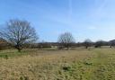
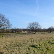
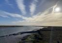
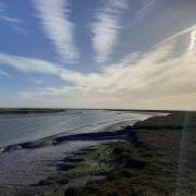
A circular walk through scenic and very quiet countryside on the eastern side of the River Pant valley
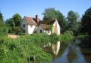
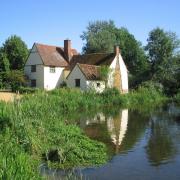
The parish church of St. Mary the Virgin, where the walk commences, is generally open to the public and merits a visit. Architecturally the tower is unusually topped by four octagonal turrets and a short central spire. Construction of the tower was temporarily halted by the outbreak of the Black Death in 1348 but a bell in the tower is dated 1380 so presumably works were well resumed by then. There are also later brick additions, including a porch and even some window tracery.
Nearby Finchingfield is famously picturesque and features in many calendars, with pubs and tea-rooms overlooking the village green and duck pond, and adjacent humpback bridge. Parking can be a problem but there is a small car park, with public toilets, by the playing field at Stephen Marshall Avenue (postcode CM7 4LZ; grid reference TL683325).
For nature lovers, West Wood nature reserve can be found two miles west on the B1051 Thaxted road. There is some parking at the entrance (postcode CB10 2SA; grid reference TL625331) and paths are defined throughout the 24-hectare site which has something to see at any time of year.
A further two miles along the B1051, Thaxted itself holds plenty of interest, with its historic Guildhall, windmill and spectacular church, as well as shops and places to eat and drink.
 on this rural route")
The Walk
1. Access the walk via a wooden gate at the rear corner of the churchyard. At a gap in the fence on the opposite side of the paddock, head left across the field, passing downhill to a wooden footbridge over the River Pant. Cross the bridge and turn right along the riverbank, before following a line of trees through a 90° angle, to the opposite side of the meadow. Turn right along the edge of the meadow, through some trees leading to a larger field. Head right and then left to follow the field edge beside the river valley floor.
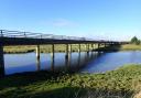
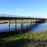
2. After 700 metres, pass through a wooden pedestrian gate. Pass, but do not cross, a bridge over the river on the right, then access a meadow via a metal field gate. At the opposite corner, ignore a metal pedestrian gate and instead go through the wooden one, leading to a meandering path in a wooded area, still with the river to the right. Emerging at an arable field, turn right to access a lane beside a ford and a quaint footbridge (marked ‘Langford Bridge’ by the Ordnance Survey).
3. Turn left along the narrow lane. Pass flint-clad ‘Stone Cottage’, then ‘Beslyn’s Barn’ and at the T-junction turn left. After 90 metres take the uphill gravel track on the right, then veer left when it forks. Pass a line of mature trees in the hedge on the left. The track then skirts a wooded area: look closely and you will see it contains an old moat, as it is the former site of a large manor house called ‘Great Winsey’. Just beyond this the track bends left, then at a T-junction turn right to access the B1053.
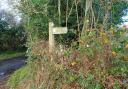
4. Head left along the verge for 100 metres then cross at the point marked by a bent plastic fingerpost, to access a path between the cottages. Go through a small wood to emerge at a large log, a convenient spot to sit for a drink and a sandwich perhaps. Then turn left along a grassy track, which soon passes more woodland on the right. At the end of a fenced section follow the field edge on the left, to emerge again at the B1053 beside a little row of cottages.
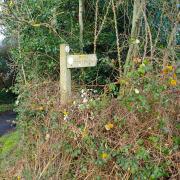
5. Turn right and a path takes you immediately back into the fields, alongside a hedge and then a wood to your right, with wonderful views off left, across the green valley to the church (your eventual destination) beyond. Fork left at a waymarker to stay on the field edge, then turn left and right, passing under power lines while keeping the hedgerow on your left. After 250 metres a gap in hedge leads to a mown greensward. Head for the visible track which then leads to a lane. Turn right along the lane for 500 metres then, through a field entrance on the left, take the path on the left which heads downhill across the field to emerge on another road, opposite ‘Mill House’.
6. Cross the road and access a field through a gap. From the rear of Mill House take the crossfield path downhill to a footbridge and kissing gate. Through the gate turn left across a meadow then from the corner of the wood veer left again and head diagonally across the meadow to a stile. Over the stile the path leads to a bridge where the Pant is again crossed; from a kissing gate at the bridge head uphill through a further pair of gates, then through the yard of Little Sampford Hall Farm. At the road turn left, then left at the junction to return to the starting point.
COMPASS POINTS
Distance: 6.5 miles (10.5km).
Starting point: Little Sampford parish church, Hall Road, postcode CB10 2QL, grid reference TL652336.
Access: Parking is possible on the verge of Hall Road near the church and village sign. This is a very rural area and unfortunately none of the route is accessed by public transport. The nearest regular bus routes are to Thaxted and Finchingfield (www.essexbus.info).
Map: OS Explorer 195 Braintree & Saffron Walden.
Refreshment: There are no pubs or shops (or toilets) on this rural route, although some facilities may be available at the church by prior arrangement. There is a wealth of facilities in nearby Finchingfield, two miles east along the B1053.