
This route from Robertsbridge to Saleshurst crosses the river between the abbey and the church
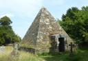
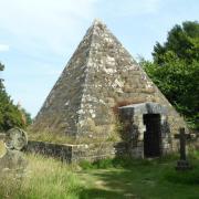
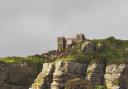
The name of Robertsbridge is first mentioned in a 13th century abbey document which refers to a bridge - Pons Roberti - and the river still contributes to the village's character. The town was granted a market charter in the 13th century and prospered. A number of medieval houses can be spotted on the High Street but the oldest known house in the village is dated circa 1390, now 1-4 Fair Lane on the first part of our trail. Later, glimpse remnants of the Cistercian Abbey's refectory, eventually dissolved as part of the Dissolution of the Monasteries.

The Domesday Book describes Saleshurst settlement as having "7 villagers and 8 cottagers, with 6 ploughs, a church and 16 acres". St Mary's churchyard is atmospheric: parts of this abbey church date from the 12th century and the notable font is rumoured to have been a gift from King Richard the Lionheart in thanks to the abbey for helping to raise his ransom when captured in the Crusades.
The George at Robertsbridge is the starting point for the 90-mile secular pilgrimage made during Hilaire Belloc's novel, The Four Men: A Farrago. The original 17th century meaning of the word 'far-rago' is 'mixed fodder' and this hotch-potch of characters, thought to represent different aspects of Belloc himself, decide to walk "through the whole county to the place we knew, and recover, while yet they could be recovered, the principal joys of the soul". The book is an important homage to Sussex culture, first published in 1911, and written at a time of great social change.

Information:
Distance: 3 miles. 1 - 1.5 hours
Terrain: mainly hard surfaces. Some roadside needing care with traffic
Navigation: easy
Where to Park: Station Road. Either at Robertsbridge Station Car Park or Robertsbridge (Station Road) Car Park is for long stay use on a Sunday only
SAT NAV: TN32 5DJ
Public transport: route starts at Robertsbridge Station
Map: O.S.Explorer 136 High Weald Royal Tunbridge Wells
Dog-friendly: yes, although much on leads
The Walk:
1) Exit Station Car Park. Turn left and walk over a bridge. Pass a shop, the Robertsbridge Club, public WC and Station Road Car Park.
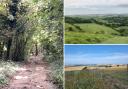
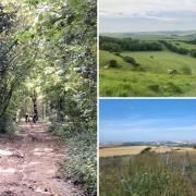
2) Turn left at the High Street. Cross and almost immediately turn right along Fair Lane. Walk to the end of the road, passing cul-de-sac Fayre Meadow. Continue straight ahead to cross a footbridge over the A21. Turn left after the bridge and walk along the wooded path. Turn right and walk along the lane. Glimpse Saleshurst to your left.

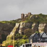
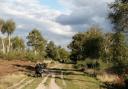
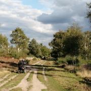
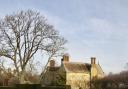
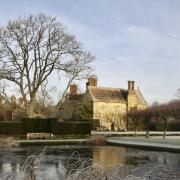
3) At the oast house and junction, walk straight ahead on the bridleway. Pass a 'Private Road No Vehicle Access' sign and walk on along the bridleway towards Greyfriars Farm. For now, walk straight on at the signpost, along the easy-walking bridleway. Reach an oast house and The Abbey, now a private home, to discreetly glimpse the distant ruins in the garden. Retrace your steps to the signpost.
4) Leave the bridleway at the signpost. Walk along a hedged mud track and across Church Bridge. Continue using stepping stones if muddy.
5) Turn right at the signpost (unless you prefer the ease of the bridleway which continues all the way to the church). Walk around the edge of the field, turning left at a marker post, and left again at a signpost to stroll towards the church tower. Walk through a kissing gate and through the church yard.

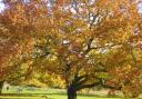
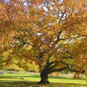
6) Walk down the church steps past the old oak tree. Walk straight ahead past The Salehurst Halt and on along the road using verge and pavement where possible.
7) Continue straight ahead at the roundabout (diverting right to use the pedestrian crossing). Walk along Northbridge Street. This becomes The Clappers and is thought to be the site of the original Pons Roberti. Continue back along the High Street. Turn right down Station Road.