
The 100 miles of the South Downs Way take you past some of Sussex’s most iconic locations from Beachy Head in the east to the Beacon Hill fort right in the west. Using Google Street View and other interactive tools you can admire these spots from the comfort of home
Click each entry for a specific walking route near each spot. Drag around the Google Street View of each location for an interactive look at the panorama
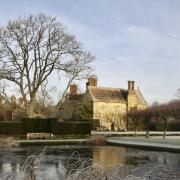
We start in Alfriston for our virtual tour of the South Downs Way and after passing by the National Trust’s Clergy House you’ll soon come to the foot of Windover Hill, home to the enormous chalk figure whose origins still remain rather mysterious.
2) Beachy Head
Following the path further east takes you to the edges of Eastbourne and eventually to the coast at Beachy Head and the Bomber Command Memorial.

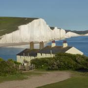
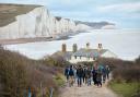
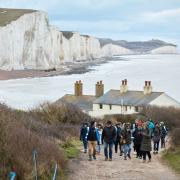
The stunning sights keep coming as you walk along the Seven Sisters Cliffs. You’ll pass the Belle Tout lighthouse, Birling Gap and the William Charles Campbell monument before arriving at the cliffs above the breathtaking Cuckmere Haven.
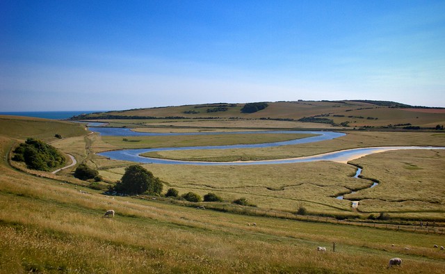
After you’ve taken in the beauty of Cuckmere Haven you’ll head away from the coast and into the Seven Sisters Country Park where the Cuckmere River winds its way towards the sea. The trail passes Westdean and Exceat and completes its easterly loop by bringing you back to Alfriston.

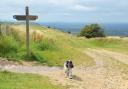
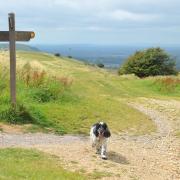
5) Firle Beacon
As we begin heading west you’ll soon reach Firle Beacon, a popular viewpoint at 217 metres high that’s also home to a number of barrows. The Firle Corn - a hill figure now almost completely lost - is thought to be connected to the nearby Long Man of Wilmington.

After descending Itford Hill to cross the River Ouse near Southease you’ll make your way back up into the hills to Kingston Ridge, a viewpoint where you can see nearby Lewes and all the way to Seaford Head.
7) Blackcap
After leaving Kingston Ridge you’ll pass the amusingly-named Loose Bottom, cross over the A27 and go through Balmer Down before reaching a crossroads on the path. Go right in the direction of Lewes and you’ll come to Blackcap, an historic area filled with burial mounds, battlegrounds and pathways that have been used for thousands of years.

Another of Sussex’s best viewpoints follows after you take a left at the crossroads near Black Cap. At 248 metres high Ditchling Beacon is the highest point in East Sussex and so appropriately has incredible 360 degree views across this part of the county as well as the remains of a hillfort for further intrigue.
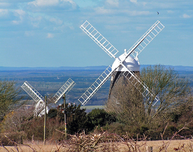
Before the path takes a left down towards Pyecombe Golf Club go a little way off the track to visit Jack & Jill and admire the view that the pair get to enjoy every day of every year.
10) Devil’s Dyke
Pass over the A273 and London Road at Pyecombe and head towards Saddlescombe before you reach Devil’s Dyke. In the warmer months this dry valley - the deepest and widest of its type in the UK - comes alive with wildflowers and various insects. No wonder John Constable called it the ‘grandest view in the world’.
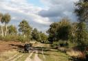
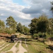
11) Beeding Hill
Leaving Devil’s Dyke you’ll pass the rather rudely named Adder Bottom and Fulking Hill before coming to another wide-ranging viewpoint at Edburton Hill. The view we have selected below, however, is at Beeding Hill, one point of a nature reserve that stretches all the way back to Newtimber Hill.
A stop at one of Sussex’s many churches combines some of our county’s best architecture with typically serene surroundings and that’s precisely what you get at St Botolph’s after passing Anchor Bottom and crossing the River Adur south of Upper Beeding and Bramber.

13) Steyning Bowl
Keep following the path as it runs south of Steyning - passing another humorous Bottom, this time one by the name of Winding - and soon off to your right you’ll be able gaze down into the beauty of Steyning Bowl.

At the top of Chanctonbury Hill lies this former prehistoric hillfort that’s been used for a variety of purposes including, bizarrely, a religious shrine dedicated to a boar cult. Despite many of the beech trees being destroyed in the Great Storm of 1987, the ring is still one of Sussex’s most recognisable natural landmarks.

15) Amberley Mount
Pushing on over the A24 near Washington - where there is a separate loop off the main trail - you’ll go over Springhead Hill and Rackham Banks before coming to Amberley Mount looming over the village of Amberley on the River Arun.

16) Toby’s Stone
Cross over the River Arun near Amberley and here you’ll cross paths with the West Sussex Literary Trail, an 87km route exploring the many literary connections between Horsham and Chichester Cathedral.
After so much walking a rest will be well earned and Toby’s Stone - a memorial to Toby Wentworth-Fitzwilliam, the secretary of the Cowdray Hounds - is the perfect spot to give your legs a rest and enjoy views all the way to the North Downs.

17) Graffham Down
With legs refreshed we keep going in the direction of Scotcher’s Bottom - yes that’s a real place - shortly before which you could briefly divert onto Glatting Beacon. A mile or so after passing Stickingspit Bottom you’ll come to Graffham Down where you’ll have views over the villages of Graffham and Heyshott.
Passing to the south of Cocking and going through Cocking Down you’ll come to this sinister-sounding location. Rather than being a place where Satan practices his mountain biking, it is actually a collection of Bronze Age barrows whose main lines align with sunset on Midsummer Day.
The legend goes that Thor used to sit on Treyford Hill and after catching the Devil jumping around on the barrows, he threw a stone at Lucifer to drive him away from the site.
19) Beacon Hill
As we near the final steps you’ll take on the South Downs Way in Sussex we head up to another hillfort with ancient origins. Sometimes known as Harting Beacon, the views to East Harting, Elsted and beyond are awe-inspiring on a clear day.

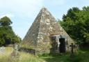
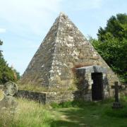
20) Vandalian Tower
Our final stop before the path takes you across the border into Hampshire is this 18th century folly on the edge of Harting Downs. It was built to commemorate the founding of the colony of Vandalia in North America yet as the colony quickly failed, the folly was soon abandoned.
Thank you for joining us on this virtual tour of Sussex’s section of the South Downs Way. If you want to make your own trail itinerary please click here.
Click here to see our selection of great walks on the South Downs.
_________