A short but steep walk up Bosley Cloud rewards you with some of the best views in Cheshire

Plodding steadily through the woodland to reach the top of Bosley Cloud, I’m following a well-worn path.
This would have been a popular recreation even in Queen Victoria’s day. A Good Friday tradition saw the local millworkers put on their
Sunday best and head for the summit with lemonade and hot cross buns.
Thankfully, this is a ‘mountain’ very much in the Cheshire style. At 343 metres, The Cloud is knee-high even to the county’s highest point, Shining Tor. Or, to put it another way, you would need to pile 25 Bosley Clouds, one on top of another, to make an Everest.
But that makes Bosley Cloud – like Tegg’s Nose, the Saddle of Kerridge and other such pimples on the Cheshire Plain – easily-attainable goals. They are the people’s mountains.
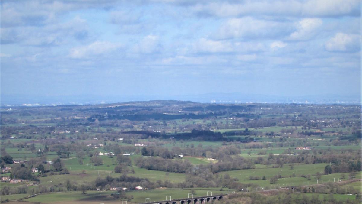
And there is no denying the beauty of the vistas to be enjoyed from these modest vantage points. In the case of Bosley Cloud, you look down across Congleton, Biddulph, Macclesfield, Holmes Chapel and swathes of Greater Manchester. And on a sunny day, it is as pretty as an oil painting.
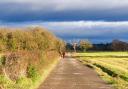
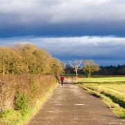
It takes only a short walk to enjoy those views, but it entails quite a few steps to get up sharp inclines and some rough conditions underfoot, so proper walking boots are advised.
1. We start from the Timbersbrook picnic area car park, off Weathercock Lane, postcode CW12 3PP. Head to the opposite end of the car park from where you entered, go through a gate and walk along a path which winds to the right and brings you to steps and thence to a lane. Go left up the lane then, less than 200m later, right through a metal kissing gate and up a stepped path signposted as the Gritstone Trail.
2. At the top of the steps you reach a wide track. Go right, keeping on this track until you see a path forking up to the left through a narrow wooden opening, with a National Trust sign for ‘The Cloud’. Take this path and, reaching a T-junction of paths less than 100m later, go left, now following both the Staffordshire Way and Gritstone Trail uphill.
3. At a stone wall with a wooden gate, pass through a narrow opening and head left through woods, but with fine views opening up across the Cheshire Plain to your left. The path can be slippery, with big boulders and exposed tree roots, but it is at least well-defined. You won’t get lost. Keep following occasional signs for the Gritstone Trail and the path climbs out of the woods, with a rocky outcrop and viewpoint ahead.
4. Make for the white trig point, where you will also see a viewfinder, pointing out that the Holme Moss TV mast is 28 miles away, Shutlingsloe six miles away and Liverpool Cathedral 38 miles away. Someone has also included pointers in the direction of Land’s End and John O’Groats, though I always thought the rule of thumb for these things was to include only landmarks you may be able to see on a clear day. After enjoying the view, continue away from the trig point in the same direction by which you arrived, onto a path bordered by logs, heading gently downhill. Go through a squeeze stile and down steps to a concrete lane. Head right, uphill, and just before the track veers right, cross the stile ahead and go right on a fenced path along the top of a field.
5. At the next stile, head right towards the woods, and follow the path parallel with the stone wall. This brings you to the gate through which you passed on your way up to The Cloud. Through the gate, go ahead until the path dips down, then take a right turn, following the Gritstone Trail and Staffordshire Way signs. At the next squeeze stile, keep ahead, pass Folly Cottage and soon after, take the path on the left, down the steps to a lane. Go left, downhill and, after passing Ivy Cottage, go right down steps to bring you back to the car park.
COMPASS POINTS
Area of walk: Bosley Cloud, near Congleton
Distance: 2½ miles
Time to allow: 1½ hours
Map: OS Explorer 268