Tens of thousands of people thunder past the Howgill Fells every day, but Keith Carter says there are good reasons to stop and explore

This walk was published in March 2015, so the details of the route may no longer be accurate, we do advise these articles should only be used as a guideline for any potential route you take and you should double check an up to date map before you set off.
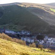
I used to look longingly at the Howgill Fells as I travelled north on the M6 as it carves its way through the Lune Gorge. Their rounded curves and dimpled folds caught the changing shadows and dusting of snow as the seasons changed and I longed to be up on them rather than stuck behind the wheel of a car.
Once I began to explore them they quickly became a second favourite after the Lake District fells, the walker's paradise. Sometimes Sedbergh would be the starting-point, either up onto the ridge via Winder or along the valley to Cautley Spout then onto The Calf. These hills scarcely exceed 2000ft and their slopes are gradual and mostly grass. You can walk all day without having to scramble over rocks, the views are sublime and the weather conditions usually manageable. As they say, what's not to like?

Tebay is the ideal starting-point for a walk in the northern Howgills which is the subject of this walk to the summit of Blease Fell if you can call it a summit since in common with all the hills in this group the tops are rounded and cairn-less. Park in the area known as Mount Pleasant opposite The Old School, once the Youth Hostel, now a café with independently run accommodation. Go in for a coffee after your walk, it's rather good.
Take the lane beside the Old School, passing a group of garages then rising away from the village on tarmac at first. Keep right at each of two forks in the lane, the second one with a fingerpost indicating left to Weather Hill and right to Tebay Ghyll. The OS map shows a farmhouse called Tebaygill and a stream called Tebay Gill, the word 'gill' coming from the Norse word meaning a deep cleft or ravine. The spelling 'ghyll' seems to have been invented by Wordsworth, believe it or not!
Once past the farm the track becomes easier, levelling out at an old barn. You can see your way ahead right up the fells ahead. To the left the land falls away to the gill and has been planted with young trees. The idea is to populate these lower slopes with broadleaf trees such as oak, ash, rowan and alder which in time will form a forest similar to nearby Borrowdale (not the same as the better-known dale of the same name in Lakeland).
Gaining height, the view down the Lune Gorge opens out and we can see how the river, road and railway have all taken advantage of this natural gap through the hills. The Lune will find its way down to Lancaster and flow into Morecambe Bay at Glasson Dock, a lovely river, beloved of fishermen. This view from the top of Blease Fell is stunning and you can sit on the grass and savour it for hours.
The return is over the adjoining top to Hare Shaw and Knott, no more than mounds really and also free from piles of stones or cairns. Lake District walkers will be familiar with the heaped up stones on every summit however insignificant but you won't find the same tendency in the Howgills due probably to an absence of loose stone lying about and few quarries. These hills were open to common grazing and were never subjected to enclosures.
Descending from Blease Fell requires some care in route-finding since there are no obvious paths, only a number of faint tracks through the grass, many of which lead nowhere. The farmers do use quad bikes here though so you can find wheel ruts in places but never really following a usable line. The descent is due north over Hare Shaw from which point by looking to the distance you should be able to see where the M6 curves to the left heading north. Take this as your general direction but avoid drifting too far to the right. Several faint paths present themselves but where a choice needs to be made, take the left hand option.
As you lose height, your path becomes more evident and in places seems to be the start of a genuine track but then fizzles out again, dodging boggy patches then coming to the edge of a cliff. Below us is the ruin of Gelstone, a long-abandoned farmstead where we turn right to follow a wall down past a second ruin then a third, this one with three concrete buttresses which speak of an attempt to stop the gable from collapsing sometime in the past. We come to a stony track climbing the fell, the access to the farm on the skyline, Waskew Head, still occupied I think. Turn left, cross the packhorse bridge over Tebaygill Beck and follow the track back to the village.
Compass points
Area of walk: The Howgill fells from Tebay
Distance: 6 miles
Time to allow: About four hours.
Map: OS Explorer OL19 Howgill Fells
Refreshments: The Old School, Tebay
Access: Not suitable for wheelchairs or pushchairs
Further reading: Walks on the Howgill Fells by A. Wainwright


