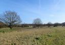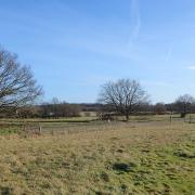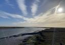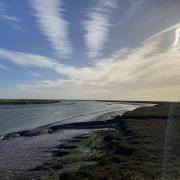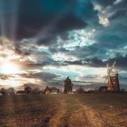
A lovely, medium-length walk through sweeping countryside with wide horizons, perfectly highlighted by the low winter sun
Words and photos: Simon Taylor on behalf of the Public Rights of Way team at Essex County Council
Distance: 4.6 miles (7.4km).
Starting point: The Plough public house, Plough Road, Great Bentley, postcode CO7 8LA, grid reference TM111216.
Getting there: From the A120 eastbound take the A133 slip. Follow the A133 over a roundabout, then take the first right onto Heckford’s Road, which leads direct to Great Bentley. The Plough is on the far side of the large village green. Just 150 metres south along Plough Road is a bus stop (route 77) and the railway station.
Map: OS Explorer 184 Colchester, Harwich & Clacton-on-Sea
Refreshments: The Plough is the start/finish point. The Red Lion on the edge of Thorrington is passed approximately halfway along the walk. For provisions, there is a small supermarket a couple of doors down from The Plough.
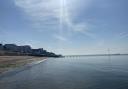
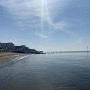
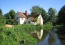
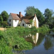
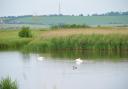
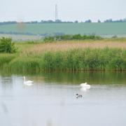
Places of interest: At 43 acres, Great Bentley village green is reputedly the second largest in England. The church of St. Mary the Virgin, passed on the walk, retains many original Norman features. Further afield, the coast beckons. Brightlingsea is to the southwest, via Thorrington, and provides opportunities for coastal walking, local sight-seeing and good birdwatching on the marsh. For more traditional seaside fun, head southeast on the A133 to Clacton-on-Sea. Alternatively, peace and isolation can be sought at Colne Point, accessed via St. Osyth.
The walk
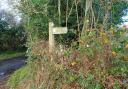
1. From The Plough, follow the edge of the huge village green, passing the cricket pavilion and a rather chilling memorial to a local group of 16th-century religious martyrs. Follow Station Road round to the right, then turn left into Birch Avenue. After 500 metres turn right into Pine Close, and towards the end the path follows an alley between numbers 15 and 16, leading to a pedestrian level crossing of the railway. Look and listen carefully and cross the line safely, then follow the field paths and go through a metal gate into St. Mary’s Hall Farm. Pass through the yard and along the lane to emerge onto St. Mary’s Road. Turn right and follow the quiet country lane, leading to the hamlet of Aingers Green.

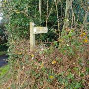
2. Turn right into Weeley Road, then at its end cross Plough Road and access the footpath on the farm track opposite. The track leads to and passes through the southern edge of Lodge Plantation, from where the path continues as a grassy strip between two fields. At its far end, turn left and then right where the path descends a few wooden steps and crosses a stile into a meadow, on the other side of which pass through a squeaky metal gate and over a pair of wooden footbridges. The path leads to Frating Abbey Farm Road; turn left and then take the path on the right across a field to a group of houses where it passes along a narrow alley between two garden fences to emerge onto the verge of the B1027 Clacton Road. Turn right and follow the verge towards Thorrington.

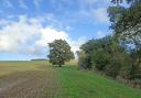
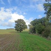
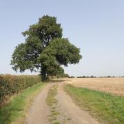
3. Soon you will encounter the Red Lion pub (on a windy day the sign has a classic spooky squeak). The path passes along a track called Rosemary Lane behind the pub and then continues off beside fields, eventually emerging back on to Frating Abbey Farm Road. Turn left, then in 100 metres take the footpath on the right through a farmyard. At the end of the fence and hedge on your right the path veers off left at an angle across the field, towards a distant lone tree. You may also notice the railway line ahead.

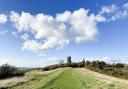
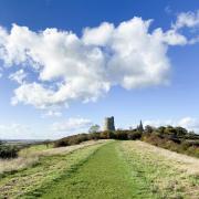
4. Once past the tree, the path crosses the railway again. This crossing has signals indicating if it is safe to cross, but still check for yourself. Once across, the path turns right and runs beside the railway, gradually dropping down the side of an embankment before veering left. Cross a concrete slab bridge, turn left and then right to follow the grassy path on the field edge, then at the top of the field turn left along a dirt track. At a gate, turn right to enter the churchyard; you are immediately met by the impressive west face of the church tower. Follow the path to the left of the church until you emerge back out onto Great Bentley village green. Turn right and The Plough is up ahead.
Interactive map: essexhighways.org/getting-around/public-rights-of-way/prow-interactive-map