Kelsall’s undulating pathways claim a likeness to the Swiss landscape but, says Paul Taylor, it’s unmistakeably Cheshire.

The more pedantic amongst you will notice that last month I waxed lyrical, likening the Macclesfield Forest to a Little Switzerland. Now here I am in Kelsall, quite by coincidence, on a path which takes me through what a signpost describes as, yes, 'Little Switzerland'.
Be assured, dear reader, that I am not getting lazy with my metaphors. Someone beat me to this one - and besides I'm not entirely convinced on its accuracy.
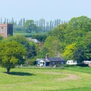
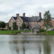
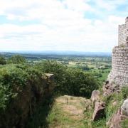
Yes, it's a very pretty spot - a steep-sided valley from which you have views across fields going off into the distance. I can see the analogy, but I'd quibble with Kelsall's Swiss credentials. There's too much pink sandstone around here to be anything other than Cheshire. It's in the dirt beneath your feet, and it's in some of the older architecture. Sandstone was quarried hereabouts on an industrial scale through much of the 19th century, a Liverpool merchant called John Gunnery having bought four acres of the escarpment just after the Napoleonic Wars. One of many structures to be made of the local stone is the lock-up - a tiny prison - which can still be seen opposite the Royal Oak pub.
And if you wonder what Kelsall did to deserve a pub as large and grand as the Royal Oak, thereby hangs a tale. The Royal Oak was built in 1900 as a railway hotel to serve travellers on a planned branch line between Tarporley and Mouldsworth. That plan was then aborted by the Railway Commissioners, leaving Kelsall with a railway hotel but not a railway.

Anyway, enough of the fun facts for now, there's a walk to be had...
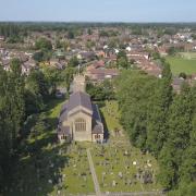
1. Head for Chester Road in the centre of Kelsall, postcode CW6 0RZ. You will find on-street parking a little tight, though if you are combining the walk with a visit to The Morris Dancer pub, there is a large car park there. Start with the pub on your right and Holmes Pharmacy on your left and walk up Chester Road, ignoring the left fork into Old Coach Road. Round the next bend, you will find St Philip's Church. Just beyond the church, take a footpath on the right, beside a lamp post with a school sign on it, and follow it down to allotments and up to a residential road. Turn left here, then next right, following the footpath uphill. Cross the next road and continue up Elizabeth Close, but as the road bends right, take the footpath on the left up steps.

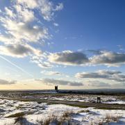
2. At the top of the steps, look back at the views down over the plain then continue ahead on the grassy path. After the next kissing gate, you reach a lane at a bend. Go right onto a gravelly track running in front of Fold Cottage, then right into a footpath signposted Willington. Another kissing gate brings you to a path across fields, bounded by an electric fence. Eventually, you come to a sandstone boulder with a sign telling you about Kelsborrow Castle - a fort which existed here in the first millennium BC.
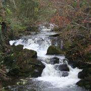
3. Go through the kissing gate and follow the path down a very pretty valley....yes, Little Switzerland. The path emerges eventually onto a lane. Keep ahead, passing some lovely sandstone houses until the lane comes to a T junction. Go right here into Chapel Lane and follow it down, passing the 1823 Methodist Chapel, now converted to a home, from which the lane takes its name. Reaching Willington Lane, go left and immediately right into Willington Road.

4. Follow Willington Road for some time, along a very straight stretch with fields on either side, passing the sign welcoming you to the parish of Tarvin. You pass a road on the right which has a signpost for Kelsall, and then Mill Lane on the left. Just a few metres later, take a footpath on the right, across fields, sticking to the left hand edge. This is the Eddisbury Way, a 17-mile path which runs from Frodsham to join the Sandstone Way on the Peckforton Hills at Burwardsley. A small bridge takes you over a stream and the path goes up the next field slightly right. Go through a kissing gate, pass four mature trees, then cross a gravel drive heading for a kissing gate ahead and to the right. Keep to the left hand field edge, through another kissing gate and you pass through another neat long line of trees to reach a wooden kissing gate.
5. Cross over two narrow drives to reach a metal kissing gate ahead. Head through the field to the wide bridge then up the next field along the right hand edge. Through the next kissing gate, go straight across the next big field. A kissing gate brings you to a grassy track. Head right up this track and when you reach a road, take the tarmac path you can see opposite and slightly to the right, passing a new housing development. This path emerges at the village green, close to The Morris Dancer.
COMPASS POINTS
Area of Walk: Kelsall and Willington
Distance: 3 miles
Time to allow: 1½ hours
Map: OS Explorer 267
Refreshments: The Morris Dancer, Chester Rd, Kelsall, Tarporley CW6 0RZ ; The Royal Oak, Chester Road, Kelsall CW6 0RR
Paul will be back next month with a seaside cycle ride to New Brighton but if you can't wait that long log onto cheshirelife.co.uk where you'll find more walks to enjoy around the county. And don't forget your camera - your pictures could win you prizes. See online for full details of our readers' photos competition and to see the entries we've already received.


