Keith Carter strolls around the gently rolling countryside of South Cheshire
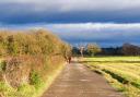
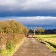
We are in South Cheshire this month, three miles from Nantwich and four from Crewe although you’d never know it. The countryside fits the description ‘gently rolling’ and our walk makes its way through pastures and meadows, climbing stiles and crossing brooks from one field to the next yet always within site of the prominent church tower of Wybunbury.
It’s no ordinary church tower, standing without nave or transept, standing indeed along the road from the church itself. Dedicated to St Chad, first Bishop of Mercia, the site chosen for the church to be built on was unstable due to the ground being a mixture of sand, salt and springs, not such a good choice, all in all.
A succession of churches built on this spot became unsafe or collapsed and after five attempts the decision was finally taken to move the church to another site, leaving the church tower where it stood. It too had begun to lean until efforts were made to reinforce the foundations. Even today it would be a rash man to guarantee that it will remain perpendicular for ever and my friend Jim said he detected a slight lean.
Since he himself has a distinct lean to one side I was somewhat sceptical. There used to be an old saying locally, ‘as crooked as Wimberie steeple,’ an interesting use of the common name for the village which is referred to as Wibbenbury or Wimbury.
The village used to be known for an annual festival known as Wybunbury Wakes, a season of idleness, dissipation and carousing which has now regrettably been discontinued. I feel that if they were to revive the practise it would attract large crowds and do wonders for the local economy. Nowadays the village is quiet and behaves itself.
Parking is at the roadside in the village since there’s no car park unless the landlord of the pub let’s you leave it there on the understanding that you call in for refreshments after your walk. Start by taking the kissing-gate on the left of the church tower, the path constructed from discarded tombstones.
Go through a second kissing-gate and keep on down a bank heading for a third kissing-gate to enter a nature reserve by a sign.
This tells us that this is Wybunbury Moss National Nature Reserve which is interesting for the fact that it preserves an area of ‘schwingmoor’ or floating peat bog, very unusual apparently and good for many species of plant and insect life. Don’t be concerned, we won’t be trying to cross it.
The path skirts the reserve to the right of it, the muddy areas crossed by improvised boardwalks then we keep slightly right, leaving the reserve and crossing two fields in which horses graze.We leave the secondpasture by a stile in the top corner, just by a symmetrical fishing-pond which we keep to the right of.
At the corner post our line is slightly left across a meadow. Aim for a telegraph pole in the middle of this field, striking across to the far boundary and when a gateway comes into sight, making for it. This is an old iron kissing-gate but we don’t go through it.
Turn right and walk along the edge of the field keeping the hedge on your left. It is along here that you will see signs with the alarming message ‘BEWARE OF SNAKES’ in large red letters. You don’t often see such a warning in the countryside and I must say that in a lifetime of wandering I have only ever seen two snakes, one in the Cheviots and one in Cornwall.
Best keep an eye out for them, I suppose, but I don’t think they’re particularly common in Cheshire.
Maintain the same line ahead to where the path comes to some farm buildings to the right, crossing several stiles and keeping left of an electricity pylon. There was a large dairy bull with his harem standing aloof here when I researched this walk but he remained indifferent to our intrusion into his field. He was probably conserving his energy.
The field path runs along the edge of one more field before meeting the road at a stile with a finger post pointing right. We ignore this signpost and cross over the road to pass to the left of some cottages then climb two stiles to enter a meadow.
Go left along the hedge and where it dog-legs to the left, at a corner post, we again need to strike off through grass being grown for silage.
Looking ahead there is an extensive farmstead to the left and our direction is to the right of it.We pass a dew pond on the right where we encountered a strange assembly of swans, fifteen of them, which took fright and flew off in alarm as we came up to them. No sign of nests. They were just swanning about.
At a crossing track leading to the farm, cross straight over and keep ahead along a right-hand hedge through a field that descends to a dike where we turn right through the hedge and walk along the dike for fifty yards to where a stile appears on the left. Cross it into a field with crops growing, the right of way going straight through the growing crop with no effort made to delineate it.Walkers find this an uncomfortable prospect, walking through growing crops which seems wrong somehow.
Some farmers leave the footpath unplanted but here no thought has been given to help with the dilemma on whether to tramp straight across or go the long way round the edge. The truth is the right of way has the greater claim and I advise you to ignore the crop and stick to the route.
Go through a gate onto a lane and turn left for 80 yards to an opening on the right where an access track leads to a recently converted cluster of farm buildings. 4When you reach a gateway, keep to the right of it to a kissing-gate going through a post and rail fence. Head slightly left, aiming for a lone oak tree under whose branches is a further kissing-gate which we go through and turn right along a righthand hedge.
The path rises past an isolated stile with no hedge and we keep ahead on the same line to the next stile in the corner, the ground falling away to what seems to have been an extensive quarry partly flooded to create a fishing lake, Jacob’s View.
A race track for 100cc bikes has been laid out here using old tyres and some attempt made to establish an area for recreation. It all looks a bit abandoned especially over to the right where a gutted house with just the walls and roof standing looks like a mouthful of broken teeth.
The path turns down left through a hedge beside a fence made from old planks stood on end then cuts across a track to a stile leading into the grounds of the ruined house. Here we come to a further ruin, oncea fine farmstead but now a deserted bomb site. Hurry past it, there’s no desire to hang about here.
Keeping the ruined farm to the right, walk on to where a track cuts across our path. Turn right and follow this track which leads to an abandoned sand quarry. At the bottom, look up to the left for a stile on top of the quarry rim and climb up to it.
Cross it and walk to the right along the rim.Where a sign says Danger Quarry Workings, go down the bank left to a stream and walk left along the stream to where a makeshift bridge crosses it on the right. Cross the stream and surrounding boggy area and walk up the field. Over to the right is another fishing lake. Old CDs have been strung across it, presumably to ward off intruding geese.
We meet a post and rail fence and by heading to the top right corner of the field we find a stile which leads us to a narrow path alongside a property called Highlands to reach a road. Go left on the road past a group of houses that include The Cliffe, a substantial half-hidden residence of some style, the village just ahead and an area known as Cobb’s Moss to the right of the road.
We are on Wrinehill Road which emerges opposite the Red Lion pub with the cemetery to the left, separated from the church tower by the lane. Turn right at the T junction and just past the Swan Inn we arrive back at the car