A delightful coastal walk in north-east Essex, with something for everyone
Words and photos: Simon Taylor, Public Rights of Way team at Essex County Council
Distance: 6.3 miles (10.2km).
Starting point: The car park at St. Michael’s Church, The Street, Kirby-le-Soken, postcode CO13 0EF, grid reference TM219221.
Getting there: From the A120 take the A133, then the B1033 at Weeley. Once through Thorpe-le-Soken, turn left on the B1034 to Kirby-le-Soken. The walk passes two railways stations: Kirby Cross and Frinton-on-Sea. Kirby-le-Soken is served by the 105 and 107 bus service from Colchester and the 98/98A from Clacton (essexbus.info).
Map: OS Explorer 184 Colchester, Harwich & Clacton-on-Sea.
Refreshment: Numerous options in Frinton, roughly halfway along the walk.
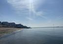
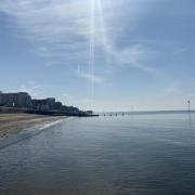
Places of interest: St. Michael’s Church is a quaint building with an impressive tower, albeit other than the 15th century tower it is largely Victorian. The churchyard attracts considerable wildlife. Two miles to the east is the traditional seaside town of Walton-on-the-Naze; at its northern end lies the Naze itself, a large headland with visitor centre, nature reserve, Victorian tower (a landmark visible for miles) and cliffs, from which fossils erode and can be found on the beach. Further south is Frinton-on-Sea, a genteel resort with a great theatrical heritage.
Interactive map: essexhighways.org/getting-around/public-rights-of-way/prow-interactive-map

The walk
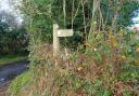
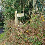
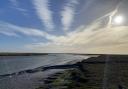
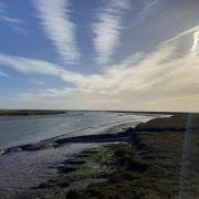
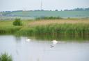
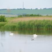
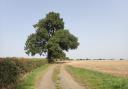
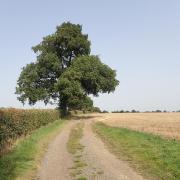
1. Exit the church car park onto The Street and turn right. Pass the war memorial, the Kirby-le-Soken village sign and the Evangelical Church before turning left down a footpath marked by a concrete fingerpost with a litter bin attached. Follow this path for 700 metres to reach the sea-wall path, then turn right. With the saltings of Hamford Water to your left, follow the footpath to the Dutch-style buildings at Kirby Quay.

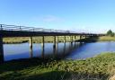
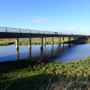
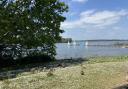
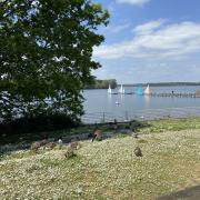
2. Cross the footbridge onto the lane, turn left and then follow the concrete fingerpost on the right, over a sluice to reach the sea wall. The well-defined path then follows the sea wall all the way to the Horsey Island causeway (aka The Wade).

3. There is no public access to the Island and causeway, so after admiring the view, head south along the track, appropriately called Island Lane. Eventually this becomes a tarmacked road, leading onto Walton Road. Turn right along the footway and then cross Walton Road to head off up a gravel track called Turpins Lane. This soon becomes just a grassy track and then just a field edge. Keeping the hedge to your right, follow the field edge as it kinks right then left then right again before passing through a hedge line to emerge at the rear of a housing area. Turn right along the path, which eventually widens into a road – the other end of Turpins Lane. This soon leads onto Frinton Road. Turn left here on the footway alongside the road and take the opportunity to cross it at some point. Pass the petrol station and the pill box in the wall and at the roundabout turn right.
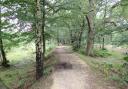
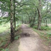
4. Pass over the level crossing, the site of the famous Frinton gates. The original gates are now displayed just outside Frinton-on-Sea station. They were operated manually and Jack Bright, the crossing keeper between 1922 and 1959, is estimated to have opened and closed them over 700,000 times, not bad considering he had an artificial leg, the result of an injury in the First World War. For a lunch break, one can head straight on here, along Connaught Avenue where there are shops and cafes galore. To continue the walk, turn right onto Witton Wood Road, and at its end cross the road and head straight on along a gravel track. Pass the allotments on your left then, as the path emerges onto fields, fork right to continue with the hedge on your left. The path rises, through fields, and on a clear day the North Sea can be seen in the distance to the left. The path then enters a wooded corridor as it follows Kirby Brook before leading out onto Holland Road.

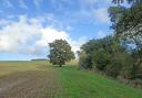
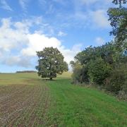
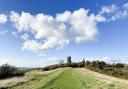
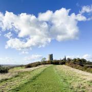
5. Turn left and cross the road with care. From the lay-by on the other side, take the first footpath along a gravel track, leading on to a field edge. After 300 metres, pass through the metal gate leading to the pedestrian level crossing of the railway (take care of trains). Through the gate on the other side bear left then right, along Station Road and out onto Thorpe Road. Turn left, then cross to take the footpath leading up a cul-de-sac called The Sheltons. Through a kissing gate, the path passes some horse paddocks before another kissing gate leads onto an arable field. Continue straight, along the field edge with the hedge to your right until a cross-field path heads off left, towards the church tower standing proud of the trees in the distance and marking the end of the walk.
Why being outdoors is vital to our mental health: https://www.greatbritishlife.co.uk/lifestyle/health/outdoor-activites-in-essex-for-wellbeing-9019720
The Essex Way in circular walks: https://www.greatbritishlife.co.uk/things-to-do/walks/the-essex-way-50-year-anniversary-9019610