Explore beautiful countryside between Purleigh and Cold Norton on the approaches to the Dengie peninsula south of Maldon. Words and photos by Simon Taylor on behalf of Essex County Council's Public Rights of Way team.

Distance: 3.5 miles (5.7km)
Starting point: All Saints Church, Church Hill, Purleigh, Chelmsford CM3 6QJ. Grid reference TL841020
Getting there: From Maldon, follow the B1018 Fambridge Road then turn left onto the B1010 Baron’s Road.
Once in Purleigh (by the vineyard) turn left into Pump Lane and left again into Church Hill.
From South Woodham Ferrers take the B1012 Lower Burnham Road then turn left onto the B1010 Fambridge Road and after 3 miles turn left onto Baron’s Road and follow the directions as above.
There is a bus stop at the bottom of Church Hill served by numerous routes (see essexbus.info)
Map: OS Explorer 183 Chelmsford and The Rodings
Pub stops and refreshments: The Bell public house is at the start/end of the walk and The Norton is approximately halfway. The Purleigh Community Shop can be found on the corner of Pump Lane and Church Hill.
Places of interest: All Saints Church is an attractive building with decorative flint and stone work.
It attracts American visitors as Lawrence Washington, great-great-grandfather of the first U.S. president, George Washington, was rector from 1632 until 1643.
New Hall Vineyard is in Purleigh and opens daily to visitors. It was opened in 1969 and is one of the oldest vineyards in the country.
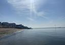
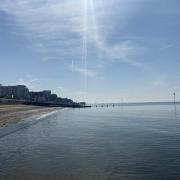
Four miles to the north, Maldon is an attractive town with the Hythe Quay providing a pleasant promenade walk, several traditional pubs, plus the opportunity to see preserved Thames sailing barges, several of which run regular trips in the estuary.

The walk
1. There is limited parking outside the church and cemetery; if no space is available, then The Bell has parking for customers.
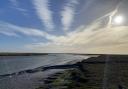
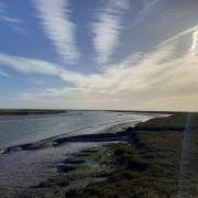
On a clear day it is worth popping into the cemetery to admire the wide vista across the valley of the River Blackwater.
Through binoculars it is possible to discern the two islands, Northey and Osea, which occupy the upper estuary.
To commence the walk, with the church on your right head east and follow the bend in the lane to The Bell pub.
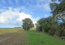
Turn left, down the hill, passing some traditional-style cottages. Enter the second field entrance on the right and follow the footpath towards the middle of the large field where, after 200 metres, it meets a T-junction with another footpath.
Turn left and follow the path towards a footbridge visible in the distance.
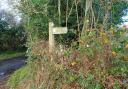
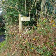
You are now following part of the St. Peter’s Way, a long-distance footpath and pilgrimage route, starting at Ongar and finishing at the Chapel of St Peter on-the-Wall, Bradwell-on-Sea.

2. Crossing the footbridge, the path heads up a flight of steps and then down another, crossing the embankment along which the Maldon to Woodham Ferrers railway used to run when it was operational (1888 to 1953).
The embankment is now overgrown and forms a pronounced wooded strip across the landscape.
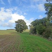
From the embankment the path passes across another field then through a wooden kissing gate, diagonally across a pasture and through another kissing gate to emerge onto Roundbush Road.
Turn right, pass Lower Barn farm cottage and then turn right again onto a track signposted as a byway.
Follow this byway and after about 400 metres you will pass between the remains of the buttresses of a bridge underneath the old railway (the arch has long since been removed).
Continue along the attractive byway route; after a further 700 metres you will see a footpath entrance on either side of the track.

3. For a short-cut, reducing the overall walk to just 4km, turn right (then follow the directions from #5).
Otherwise, turn left through a wooden kissing gate and follow the field edge on the left to the far corner and another wooden kissing gate.
From there the footpath is bounded on either side and leads to a footbridge and then a boardwalk (constructed from recycled plastic), after which the path turns left to emerge after 70 metres onto a wide driveway.
Turn right and follow this route, which emerges onto Latchingdon Road in Cold Norton.
4. For some mid-walk refreshment, turn left here and you will soon find The Norton pub.
Built at the same time as the railway you crossed earlier, this used to be The Railway Hotel but when the railway closed it continued as a pub and the name was changed, the pub also adopting similar branding to the motorcycle of the same name.
Otherwise, turn right and follow the road through the village of Cold Norton, passing a variety of interesting houses.
At some point you will need to cross the road as the footway ends on the right-hand side.
After 500 metres the road bends left but cross over (take care) and head up Howe Green Road.
Pass a sign with the wonderful place name ‘Purleigh Farther Howe Green’ and a faded image of a bittern; apparently Purleigh can be translated as ‘Bittern clearing’ and the bird has been adopted as a symbol for the village.
At the sharp bend in the road, between a field entrance and the driveway of Hillview is the entrance to the other end of the byway you were on earlier.
Take it and follow the route until you arrive back at the footpath crossing encountered earlier (#3) then take the left-hand path.
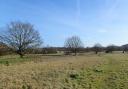
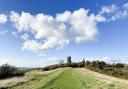
5. Just through the gap into the field, pause and enjoy the view to the right.
Purleigh hill, topped by the church, lies in the foreground while in the distance to the right are Maldon, Mundon, the Blackwater and, on its opposite bank, Heybridge Basin and Goldhanger.
Cross the field and go over a culvert then continue straight along the next field’s edge to a gap on the left, emerging onto a green.
Turn right and then right again after just 30 metres, down a waymarked path through a woody copse.
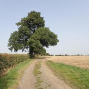
A footbridge leads out into a wide arable field crossed by the path; you should just be able to see the stile on the other side, some 25 metres right of a prominent oak.
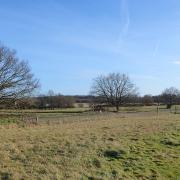
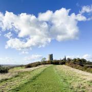
6. Cross the stile into a meadow. The wooded high ground immediately to your left is the remains of a motte, thought to pre-date the more usual Norman age of such structures.
In the far distance to the right can be seen a far more modern structure: the decommissioned nuclear power station at Bradwell.
Follow the path across the meadow to a metal field gate and on to a lane beyond, which leads to the rear of The Bell.
Here a fingerpost directs you through ornate metal gates to the left, leading into the churchyard where the path passes along a lovely avenue of yew bushes to emerge back at the starting point on Church Hill.
Visit essexhighways.org for an interactive map.
Like what you read? Why not subscribe to Essex Life?