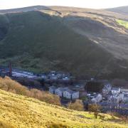
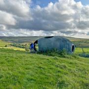
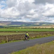
This short walk from Grange over Sands to the summit of Hampsfell gives some spectacular views
Grange over Sands is an ever-popular resort in the northern outpost of Lancashire across Morecambe Bay. Grange or Graunge is a French word meaning granary and the monks of nearby Cartmel Priory stored their grain here until Henry VIII dissolved England’s monasteries in 1536.
Until the coastal railway arrived in 1857, Grange was a quiet and undeveloped fishing village. The coming of the railway brought wealthy industrialists from Lancashire and Yorkshire, keen to breath in the bracing coastal air, who built fine houses, hotels and grand terraces many of which are still standing.
There are now lots of places to eat and drink around the town and the travel writer Bill Bryson named Grange among his favourite short break destinations in the UK.
I wanted a short walk with good coastal views and the one I planned seemed ideal. It was – and a lot more besides.
1. Leave the car park and walk up to Main Street and turn left. Turn right at the church and then right onto Hampsfell, then stay on the road as it climbs uphill eventually steeply. Just before Hampsfell House there is a track leading left with a footpath sign and this seems the obvious way to go but it isn’t. Keep on Hampsfell Road and follow this and now the tarmac road gives way to a wide gravel track.
Note: Grange over Sands owes its existence to the railway arrival in Victorian times that turned it from a fishing village into a seaside resort. It was simply called Grange but the Over Sands was added to avoid confusion with Grange in Borrowdale near Keswick.

2. The track reaches a fork with a wooden bench and a footpath sign. Turn right and follow the track as it goes through some woods with a wall on the right to reach a wooden gate. Go through the gate and immediately turn left to reach a footpath that immediately forks, take the right fork and follow the path uphill getting steeper as it does.
The path starts to level out and then head diagonally right to reach a wall and keep this on your right as you follow the path. When the wall turns right, keep straight on to a small knoll and once up this bear left towards a square building on the summit of Hampsfell at 727 ft/222m above sea level.
Note: The building at the summit is called the Hospice and is a well-built limestone shelter inside which are benches and a fire place. External steps lead to the roof and on this is a drum with numbers written on it and a moveable pointer, called an alidade. There is a board with various landmarks and mountains each with a number that corresponds to a number on the drum. The pointer is moved to the number on the drum and then points directly to the land mark or mountain. The 360 Degree views from the roof are fabulous and on a clear day, hours could be spent simply admiring them.

3. Leave the Hospice by taking a path going downhill from the left hand side of the building from the front door. Reach and cross a stile in a wall and then as the path forks keep left and at the junction where the path meets a path going right to left keep straight on to reach a metal gate with a stile next to it, cross the stile.
There is a wall going downhill on the left and, keeping this on the left, carry on downhill. The path is a little indistinct but as a building comes into view, start to bear diagonally right to reach a bit of track that leads to a wooden gate and stile. Cross the stile and the lane to a stile directly opposite and cross this and then head diagonally left down to a metal gate to the left of a house. Go through the gate onto a track and follow this downhill then turn right into a farm yard. Almost immediately on the left there is a building with ‘Footpath’ and an arrow painted on it pointing to a stile. Cross the stile and with a wall on the right follow the path to reach and cross another stile and turn left.
Follow the path behind the wall of a house then turn right and follow the path down to a track and then turn right to reach a road called Ashmount Gardens and turn left and follow the road.

4. Ashmount Gardens is a cul de sac with a house facing the road at the end. To the right of this house is an unmarked track, go down this and join a road called Eden Mount, then turn right and head downhill.
The road bends right into Charney Road and at this point keep left into a narrower road Charney Well Lane and keep following this steeply downhill until it reaches Hampsfell Road, then turn right and reverse the route past the church and back to the car park.
Compass points

Start and finish: Car park near the garden centre and lake
Distance: 3.5miles/5.6km
Time: Two hours
Terrain: Good walking on roads, tracks and footpaths. Walking shoes or boots will be fine.
Map: OS Map OL7 The English Lakes South Eastern Area.
Facilities: Public toilets in Grange over Sands near the car park.


