This five mile hike up Hartsop Dodd provides some of the region’s most spectacular views, as John Lenehan discovered

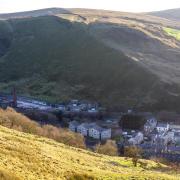
When approaching the foot of Kirkstone Pass from Ullswater, the prominent conical peak of Hartsop Dodd sits to the left of the road and its apparently vertical north face rises above the small hamlet of Hartsop. I have climbed this face of the fell but it is very steep and a lot of hard work. A better way, in my view, is to walk up the long valley of Pasture Bottom and climb to the coll of Threshwaite Mouth then Stony Cove Pike and approach the summit of Hartsop Dodd from behind. The views this way round are fantastic.
Directions
1. Leave the car park through the gate leading into the farm yard.

2. Turn immediately right and cross the bridge over the river and straight on to a wooden gate. Don't be tempted to take the track on the left before the gate. Go through and turn left and follow the track.
Note: Down to the left there are the remains of a disused mine and, although the buildings have gone, there is still the water wheel pit and the pillars that carried the mill race down from the once dammed Hayeswater Gill. It was called Myers Mine and ceased production in 1878 after being flooded.
The track eventually turns into a path turning right into Pasture Bottoms. Keep on this as it climbs gradually up the valley. The obvious coll of Threshwaite Mouth comes into view and looks a daunting climb at this point of the walk. The path is indistinct at times but is mostly visible until the climb up the coll when it picks its way up the steep climb and needs a little care to follow it through the rocks.

Climb up to the coll to a point where the path forks and take the left fork, the right fork leads to a rockier climb with the path indistinct.
Note: It is worth taking time to admire the views from Threshwaite Mouth towards Troutbeck and beyond.
3. Threshwaite Mouth. The path up to the coll reaches a wall, cross this and turn right and follow the path that leads up to Stony Cove Pike. The path is indistinct at times and a little bit of scrambling over rocks is needed. Once over the steep rocky climb the path levels off over open fell to the cairn of Stony Cove Pike. At the cairn, bear diagonally left from the path you approached from and join a path to a wall junction.
4. At the wall junction one wall goes straight on heading towards John Bells Banner, the other left towards Troutbeck. Turn right and keeping the wall on the right follow this all the way to Hartsop Dodd. Note: If you look left down into Caudale you can see the disused Caudale Quarry and mine. The mine was worked by the Shaw family of Coniston and in 1940 Bill Shaw worked there. This was just one of many other mines he operated during his working life. He was probably the best known mining engineer in his day and built up a splendid collection of mineral specimens that can be seen at the Keswick Mining Museum.
5. Hartsop Dodd summit is possibly one of Lakelands finest viewpoints but I am not going to describe them here. Pick a clear day to do the walk and see for yourselves but prepare to be amazed. Now comes the hard part. After all the climbing up to Stony Cove Pike it is a pretty gentle walk to Hartsop Dodd but the old legs will be a bit tired and, the descent back to Hartsop hamlet is very steep and grassy. Keep following the wall until it ends then head straight on downhill, there are some metal fence posts that serve as a guide for the first section but it's a pretty obvious path and not too steep at first but then becomes really steep and the narrow path zig zags down the fell side until it reaches a wire fence and wall. At this point turn right and, with the fence and wall on the left, carry on steeply downhill to a stile in the wall corner, cross the stile and keep on downhill to reach a gate go through this and cross the bridge and go through the gates back to the car park.
COMPASS POINTS
Start/finish: Car park in Hartsop
Distance: 5 miles/8 kms
Ascent: 2103ft/641metres
Terrain: Relatively easy at first then a steep rocky climb. The early climb up Stony The descent from Hartsop Dodd is extremely steep. Good boots and outdoor clothing is needed. Walking sticks are needed if unsure on steep ground. Not a walk for bad weather.
Time: 4 hours
Watering hole: Brotherswater Inn Excellent food and real ale.
Map: OS Explorer OL5 The English Lakes North Eastern Area


