Keith Carter returns to Brierfield to find the old office he hated has been converted into flats

It must be ten years since Brierfield was my place of work, my first and only experience of open plan desking, one of the worst office organisations ever devised. How do you put your feet up on the desk with 50 other wage slaves looking on? We worked on the third floor of a converted mill which was submitted for an architectural prize, coming eighth equal but what should I find on returning to Brierfield for a walk – a housing development where the mill used to be.
Named Quaker Heights, it is promoted under the slogan ‘a home to love’. Some units had rather a fine view of the M65 motorway. I’d like to report feelings of nostalgia at revisiting this place but can only honestly say I wish a bomb had been dropped on it. But that’s another story.
Brierfield has a certain air of neglect. I’m not sure what it would take to breathe new life into it but so far whatever regeneration has been attempted has been a failure. Anyone got a few hundred million to spend on it?
I parked at the station, pausing only to read the information panel which told of its past glories including the fact that watercress used to be shipped out from here, the station platform resembling at times an overgrown forest. Walk downhill as far as the bridge over the Leeds Liverpool Canal and turn down onto the towpath, passing under the bridge.
Another information board here has yielded to the ravages of mildew, all interesting details about the Tacklers Trail obliterated. Stay on the towpath which has a tarmac surface for the first quarter mile then leave the canal at the next bridge and turn right onto a farm track descending towards the river. The right of way has been diverted to avoid a converted farmhouse, leading down to where a footbridge crosses Pendle Water which flows into the River Calder.
Over the footbridge turn left and follow the riverside path with the M65 motorway to our right, a continuous roar. We pass a group of cottages and meet a lane, turning right to enter a wood where rubbish is dumped. Look for a footpath sign on the left and take the steps up a bank to emerge on a road. cross straight over, down steps and keep forward through an improvised barrier into a field heavy with mud when I researched this walk. Head up this field, the motorway still beside you and at the top corner a gate brings us to a footbridge high above the M65.
Once across the footbridge we find a stile with Pendle Way markers on it, the witch on a broomstick symbol. Take the field path in a rising field for a short distance then spot a footpath sign in the left hedge taking the path across a footbridge. Follow the right-hand boundary hedge through two fields until in the third field the path narrows down and drops into a dell where a footbridge takes us across a stream.
Climb the bank on the far side at the top of which we meet a tarmac drive with a way mark on a post directing us right. The view down to the left is of a sewage works. Proceed on the tarmac drive and where it bends to the left we need to go through the gate on the right and head up the field towards a pylon on the brow. Stick to the fence on your right, skirting a wooded valley known as Spurn Clough which is in fact the route of the right of way but which was impenetrable when I was there, forcing me to take to higher ground.
By keeping along the fence you will come to a stile closely followed by a second, this being the one we want. Climb it and descend by a flight of steep steps to the valley bottom and cross the stream by a footbridge then go up an equally steep flight to reach a field by a stile. Keep forward alongside a left-hand hedge consisting mostly of holly on which fieldfares were feasting and at the next stile we reach the road, Greenstead Lane. Cross directly over to the driveway of The Old Vicarage although the sign on the gatepost says only Plantation Cottage which is the white house next door.
Beyond the houses a yew avenue leads to a wicket gate into a field and at the next stile the path becomes enclosed bringing us to the road at Reedley Hallows a name that belongs in a Victorian melodrama. The pub here, once the Forest, is now Babar Elephant serving Indian food. It was closed. Two men were trying to make themselves heard having arrived to do some work inside and I enquired whether they got free curry when working there. “Not if we can’t get in we don’t,” was the reply.
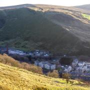
Turn right here and walk on the verge to where the road bends to the left. There’s a gate on the right and on the other side a wicket gate where an enclosed footpath goes beside a workshop. At a stile we enter a field and keep forward beside a left-hand wall over which Brierfield can be seen, the dome of the mosque prominent where once there was a forest of chimneys.
At the bottom of the field we meet the driveway to a concealed house and turn left to emerge onto the road at a bend. Turn right and in a few paces take the footpath on the left which cuts off the corner and avoids the traffic. Re-emerge onto the pavement and head back to the station across the broad motorway bridge and up the hill the other side where rows of back-to-backs have been demolished as part of some urban regeneration scheme. Did I really work here? I did, but I don’t recall it with any warmth. Work after all is what you do between walks and you can quote me on that!
Compass points
Area of walk: Brierfield and the Pendle Way
Distance: 5 miles
Time to allow: 2-3 hours
Map: OS Explorer OL21 South Pennines
Refreshments: None on the walk.
Not suitable for wheelchair or pushchairs
keith will be back next week with another walk in the Lancashire countryside. And you can find more great routes online at lancashirelife.co.uk.


