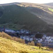
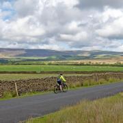
Keep away from the crowds on this beautiful walk through a quiet corner of Roeburndale
I was introduced to this area by my sisters and I have to admit it is certainly a beautiful area of Lancashire. It is not the most walked area either, so path finding for this walk was a bit challenging at times but now I have drawn a map and described the walk it should be much easier for fellow walkers.
1: Leave the car park and turn right and follow the road over two bridges and keep on until a track appears on the right with a sign on the gate saying ‘Haylot’. Follow the track all the way to Haylot Farm and enter the yard via a gate then turn immediately right. There is a sign saying ‘Public Footpath to Littledale’. Follow the good track until it reaches a metal gate that leads into a road.
2: Once on the road, turn right and follow a track through a gate marked ‘Winder’. The track forks at the entrance to the farm of Winder, take the left fork, there is a footpath sign and follow the track/path as it passes the gable of a barn and crosses a small yard and through a metal gate. The track gives way to an indistinct path. Follow this, with a broken wall and a wire fence on the right, and carry on to a gate stile by a steel gate. Cross the stile and then bear diagonally right downhill to a gate stile leading down into Warm Beck Gill. Cross the stile and bear left with a wire fence with footpath markers on the posts on the right and drop into the valley and cross the stream then, as the fence turns right, go straight on up the steep climb towards a footpath marker post and then cross a stile in a wall into an open field.
Keep straight ahead and eventually start to pick up a wire fence on the left and keep on and go through a wooden gate and then, with a new looking wall on the right, keep on then go through a metal gate and then keep on to reach a wooden gate on the right and to the left of this is a stile in a wall.

3: Cross this into a track and follow this downhill with a prominent line of trees on the left and then follow the track as it turns left and goes through the farmyard of Thornbush and then down to the main road. Turn left and follow the road then take the second turning on the right with a footpath sign and a sign saying ‘Back’, and follow the track down to Back Farm.
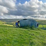
Do not go through the entrance gate to Back Farm but turn left and go through a metal gate and then follow the footpath with marker post that leads down into a valley and cross the footbridge, then follow the markers uphill and follow the path to a wooden gate with a footpath marker to the right of the gable of a grey building. Go through the gate and keep the gable to the left then at the end of this keep on going downhill, bearing left to pick up a wire fence on the left. Follow this to a stile on the left and cross this and bear right to a stile and cross this into a wood. Turn left and follow the path and some very steep steps down into the valley. At the bottom, cross a stile then turn left and follow the path through a gate leading the buildings of Middlewood Trust.

Note: Middlewood Trust is a charity that teaches sustainable skills such as designing and building the very unusual houses here, plant and vegetable growing and foraging. They also rent out accommodation for individuals and groups. Details are on Facebook and online.
4: Follow the track through the group of buildings and then bear right and follow the multi coloured sign post saying ‘Camping Barn’. Follow the track downhill to a wooden gate and a stile and go through this, again there is a multi-coloured sign post, and then follow the track until it reaches a small set of steps on the right with a footpath sign. Go over the steps and drop down the steep path to a footbridge over the River Roeburn.
Cross the bridge and keep straight on to a wooden gate and go through this then keeping left follow the track as it climbs uphill eventually getting steeper to a wooden gate with a ‘Keep dogs on a lead’ sign on it. Go through the gate and straight on to another gate, then follow the path.
Note: In 1967 a torrential rain storm on the fells above Mallowdale pike caused a massive surge of water down the Roeburn valley carrying trees and boulders that smashed into the village of Wray with such force that it demolished buildings and carried away bridges.
5: Reach a wooden post with two footpath signs, turn left and reach and go through a gate, then turn right and there is a stone stile on the right hidden by bushes, cross the stile and then keep a hedgerow and a bit of a stream on the right and keep on to another stile and cross this (there is a barn up to the left) and carry straight on to a stile in a wall. Cross this and the track into Outhwaite Farm and then another stile and enter rough moorland and keep straight on to pick up a wall on the right.
Keep on and the path goes between two walls to reach two gates, take the right hand gate and, with a wall on the left, carry on following a rough path to reach another gate and go through this into open land. From here it is important to keep to the wall on the left as there is no distinct path. Follow the wall to the wall corner and cross the stile and keep a now ruined wall on the right and keep straight on, there is a wooden guide post ahead followed by another that leads to a stile in the wall ahead, cross this stile and keep straight on. This time there is a ruined wall on the left and straight ahead a solitary tree, aim for and pass that and cross a ruined wall and keep straight on to a wall ahead. Reach the wall and turn left uphill and there is a stile in the wall on the right, cross this and cross a wall into a field with a barn to the left. To the right of the barn is a ladder stile cross this.
Note: On the map from the ladder it would seem the more obvious route would be to bear slightly right and follow the footpath route to above Park House and into Pedder Gill and on to Lower Salter. We tried this on our first attempt of this walk and found damaged stiles and then found due to past major flood damage in Pedder Gill the descent down to a makeshift bridge is extremely steep and unstable. As it was late in the day we climbed down to the bridge but would not recommend it.
6: Once over the stile, there is a wall on the left with a bit of a track, follow the wall to reach a gate stile on the left. Go through the gate stile and then keep a wall on the left that becomes a wire fence and keep on to another gate stile and go through this then turn left and follow the track to reach a tarmac road and a grey metal building in front.
Turn right into Harterbeck Farm but at the end of the grey building turn left and follow a track down through a gate then to a stone footbridge marked ‘Ford’ on the map. Keep following the track with a wall on the right and when the track bends sharp left, keep straight on and follow the wall downhill, then bear left downhill to a footbridge and cross this but do not go left through the gate stile, turn right and follow the path uphill then bear straight on up towards a wooden gate and stile.

Cross the stile and turn right and head directly across the field to a gate stile in a wire fence and cross this then head straight on to a gate in a wall with a track behind it. Go through the gate and follow the track down through Lower Salter Farm yard and join the main road at a chapel. Turn right and follow the road back to the car.
Compass points

Start and finish: Small car park near Barkin Bridge south of Wray
Distance: 7.8 miles
Time: 4 hours
Terrain: Tracks, footpaths and open fields. Good boots would be the better option. There is one very steep descent to the River Roeburn after Back Farm and could be difficult in or after wet weather and in this case walking sticks would help.
Map: OS Explorer OL41 Forest of Bowland and Ribblesdale.
Facilities: There are no public toilets or cafes on route.


