Simone Stanbrook-Byrne explores around Great Torrington, a town that played a strategic part in the English Civil War

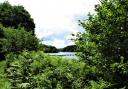
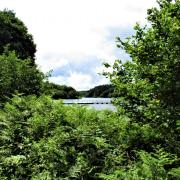
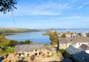
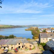
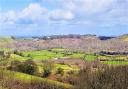
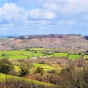
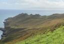
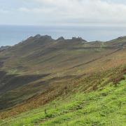
Great Torrington oozes history and, even if you get no further than the start point, it’s worth coming here just for the astonishing view from the car park. The River Torridge meanders through the valley. Below to the right is the village of Taddiport (meaning ‘toad gate’). Just to the left of the village are two long narrow ‘leper strips’, once part of seven similar fields. These are all that remain of an old mediæval farming system which was used by inmates of a leper hospital at Taddiport during the 13th to 14th centuries, enabling the patients to grow their own food.
Later, during the English Civil War, Great Torrington was a violently busy place. First a stronghold for Royalist troops, Thomas Fairfax took the town from them at the Battle of Torrington on 16 February 1646, the end of Royalist resistance in the West Country. The date explains the unusual name of the café.
But, unbeknown to Fairfax, the Royalists had been using the church to store gunpowder. A stray spark ignited this, blowing the roof off the church where Fairfax had housed around 200 prisoners. They, and many of Fairfax’s men, were killed and the church largely destroyed. It was rebuilt in 1651, the victims buried under a long tree-topped cobbled mound outside the church, which makes for an interesting extra stretch at the end of walk. An annual, torch-lit re-enactment commemorates the date.

Elusive otters live along the river, although are unlikely to show themselves.
When winter days are short it’s good to head out and make the most of whatever daylight shows itself and this is one of the most well-benched walks I know. Take a flask and drink in the views along with your coffee. To extend your day out, Torrington is home to Dartington Crystal (check winter opening times) plus the RHS Gardens at Rosemoor (open daily) – both great places to visit.

Route:
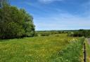
Leave your car to enjoy the view and head for the back left corner of the car park where a gateway, low down in the surrounding stone wall, leads into the view and onto some of the extensive ‘common lands’, given to the town in the 12th century. Beyond the gateway turn right along the path, known as The Old Maid’s Walk, the wall on your right and a vast view to your left. Follow the path when it bends sharply left down steps.
Within 150m you meet another descending path, turn right along it and continue downhill, staying on this path and ignoring any others to left or right. The river is down to your left as you gradually drop towards it; other walkers on the zigzags below giving the feeling of an ‘Escher’ painting. At the bottom a stone plinth shows that this is the Millennium Path. Beyond here you meet a broad track, turn right along it.

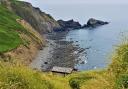
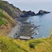
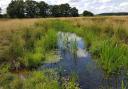
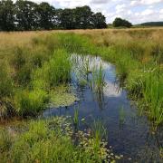
The track immediately forks. Keep left on the path nearest the river, still below to the left at this point. At the lane turn left, passing the Old Toll House and a public footpath stile on the left, to reach Taddiport Bridge. Enjoy the river views from here then retrace your steps a few metres back to the stile, turning right off the lane to walk through the field beside the river, now to your right. This is a lovely stretch of the walk.

At the end of the field bear left away from the river to a gap in the fence. Go through here to meet a broad track, but rather than following the track go immediately right down a narrow path that passes through a chicane of metal fencing. Walk ahead beyond here and you’ll soon find yourself on a delightful, squirrel-rich path under trees beside the river. The way can be narrow at times. Don’t slide in.
You eventually see steps going up left to join the track above you. Ignore the first flight but take the second, as the narrow path becomes rather less navigable after this. Turn right at the top of the steps to follow the track.
As the river bends right, in about 400m, a broad path comes down from the left. Turn left up this, you will probably hear traffic on the road above. Small waterfalls cascade attractively to the right of the path. This is ‘Lady Wash’ where, in Victorian times, young girls came to wash their faces on May Day morning, a custom thought to make them beautiful.
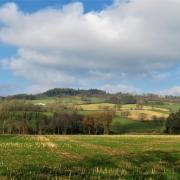
The path ascends to meet a flight of steps ahead. Turn left along the path at their top, walking away from the road. Ignore the almost-immediate left fork and keep ahead, climbing gently on this narrow, well-surfaced path and ignoring any other paths off until you rise to meet the Monument, erected in June 1818 to commemorate the Battle of Waterloo three years earlier.
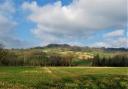
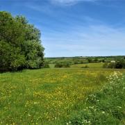
Savour the fabulous views from here. The Monument has its own eco-system: hibernating snails love its crevices. Look straight up the edifice at the tufts of ivy-leaved toadflax softening its edges against the sky.
From here take the good path heading away from the view, George’s Path. Stay on this as it climbs to a left bend where there is a memorial bench to George Charles Stacey for whom the path is named. Continue uphill on his surfaced path, soon walking with the airy view to your left once more. At the end of George’s Path continue along the row of well-placed benches, dating from various mayoralty incumbencies, and beyond them rejoin the path below the lofty car park wall. Follow this back to the gate through which you started the walk earlier.
It’s good to round off the walk with a visit to the Secret Memorial Garden near the car park’s entrance (usually closed Sundays). This tranquil place commemorates the sad deaths during World War Two of five boys who were staying at nearby Sydney House, some of them refugees from London. They were killed in a fire that destroyed the house.
For those who wish to visit the church, turn right out of the car park and at the clock tower turn left along High Street. At the end of the square a narrow path leads to the church.
Next month we head for Butterleigh
Start point: Sydney House Car Park, South Street, Great Torrington. Grid ref: SS494189. Postcode: EX38 8AA (although this may mislead sat navs).
Directions to start and parking: Great Torrington is on the A386 in North Devon, nearly eight miles south of Bideford.
Public transport: The town is well-served by buses, details from travelinesw.com.
Map: OS Explorer 126, Clovelly & Hartland 1:25 000.
Terrain: Paths, tracks and fields. Tiny stretch of lane. The riverside walking is likely to be muddy.
Distance: 2 or 3 miles/3 or 5km
Dog friendliness: Very good
Exertion: Easy start, then a sustained uphill during the latter stages with plenty of benches
Toilets: In the car park
Refreshments: Brown’s Delicatessen, 37 South Street, 01805 622900; Cafe? @ Torrington 1646, Castle Hill, 01805 626146. Opening times of both these vary. Nearby Rosemoor Garden Kitchen is open daily, serving home-grown food.
Look out for:
Historic ‘leper’ fields
Waterloo Monument
Historic town features
Vast views