Explore countryside once called ‘as gentle and dreamy as any that a lover of England could hope or wish to find,’ by writer Clifford Bax in 1939
Words and photos: Simon Taylor, Public Rights of Way team at Essex County Council.
Distance: 6.5 miles (10.5km).
Starting point: The car park at Fyfield Village Hall, Houchin Drive, CM5 0RG, grid reference TL567067.
Getting there: From the south (A414 at Ongar) or the north (A1060 at the Rodings) take the B184 towards Fyfield. Once in the village, turn off the B184 into Houchin Drive and follow signposts to the Village Hall. There is a bus stop on the B184 at Houchin Drive, served by the 46 Chelmsford – Ongar bus route (essexbus.info).
Map: OS Explorer 183 Chelmsford & The Rodings.
Refreshments: The walk passes both pubs in Fyfield: The Black Bull and The Queen’s Head.
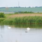
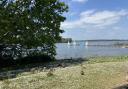
Places of interest: St. Nicholas’ Church in Fyfield is an interesting mish-mash of architectural styles but makes resourceful use of Roman tile in its fabric. Sitting isolated in fields to the north of the walk, St. Botolph’s is the parish church of Beauchamp Roding and an imposing local landmark.
Fyfield Hall is reputed to be one of the oldest surviving timber-framed residential buildings in England, while Elmbridge Hall was built in 1885 as the West Ham Truant Industrial School for Boys.
Interactive map: essexhighways.org/getting-around/public-rights-of-way/prow-interactive-map

The Walk
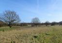
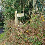
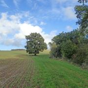
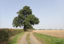
1. Leave the car park along Houchin Drive and at the first bend take the footpath between a fence and a hedge, emerging at the other end beside the B184. Cross carefully, turn left then right into Moreton Road, then turn right to follow the footpath along the track to Lampetts Farm. After 200 metres a waymark post indicates the path leaves the track. Follow it, and pass through a kissing gate into grazing meadows, then through another kissing gate and over a footbridge. Emerging onto arable land, the path passes through a gap in a hedge. With the hedgerow on your right, follow the field edge to emerge onto a byway.

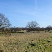
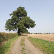
2. Turn left and follow the byway to Norwood End. At the tarmacked lane turn left again, then at Green Farm continue onto another unsurfaced byway, which leads to Claydon’s Green. Cross the lane there and take the signposted footpath on the field edge. After 100 metres, follow the hedgerow to your left and at its end turn right and follow the path across the field to a footbridge. Continue with the hedgerow on your left, cross another footbridge and then take the path across the field, heading to the left of the copse on the other side.
3. Here the path meets the B184; cross carefully and take the field-edge path opposite. Follow the field edge left and right until it meets another path and turn right, going downhill across the field towards the leftmost of two bridges, with wooden handrails, entering a small wood. Turn left after a large oak tree then in 100 metres turn right and immediately fork left (there are lots of rides in this wood), to emerge over a footbridge with metal handrails onto a field edge path. Follow this for 800 metres, to Birds Green Lane.
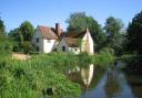
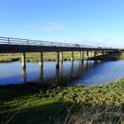
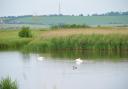
4. Turn left onto the lane, then turn right. Cross the bridge over the River Roding then take the footpath on the right, which follows the river to Miller’s Green where the path meets a lane. Turn right, then follow the footpath beside the driveway of the thatched cottage at Hydes. At the footpath T-junction turn left, then right, where you join the Essex Way. Follow it across a field then around the edge to cross a footbridge onto a lane by the junction with Fyfield Road. Turn left and follow the road for 350 metres before turning right at a fingerpost (still on the Essex Way).

5. The path crosses a field to a footbridge and then over another field before circling a paddock and passing between railings to reach Willingale Road. Turn left along the lane, then turn right at the footpath signed by the property called Wit’s End (leaving the Essex Way as you do so). The path follows a field edge then skirts right and left around a large conifer hedge to eventually reach a concrete bridge back over the River Roding. Over the bridge, fork right and follow the path across the meadow. Across the stile at the end is The Black Bull pub.
6. From the pub, turn left along the main road then left again, just before the post office, into Queen Street, where The Queen’s Head pub is just on the corner. At the sharp bend towards the bottom of the lane is a footpath signposted to the right; follow it to the playing field and back to the Village Hall.
You may also like this circular walk in Kirby-le-Soken: https://www.greatbritishlife.co.uk/things-to-do/walks/circular-walk-kirby-le-soken-essex-9096442