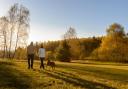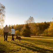

Refresh yourself with a grown-up walk through Bodmin to the ancient village of Advent

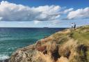
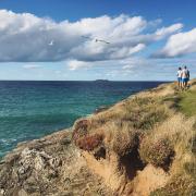
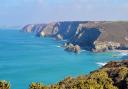
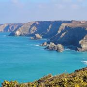
Far from the madding crowd, this gentle walk on the northern edge of Bodmin Moor gives fine views of its two highest tors and Cornwall’s highest points, Brown Willy (1378ft/420m) and Roughtor (1313ft/400m). The route is accessible from Camelford by the Camelford Way to Advent (add 2.5m/4km) and forms a circuit across ancient fields separated by high hedge banks and winding lanes.
Advent is not a village, but a parish and its church, St Adwena’s, stands in a quiet spot amid green fields. It dates from the 13th century, but was enlarged in the 15th, when it gained its aisle, arcade, wagon roof and ceiling bosses. The tower is exceptional in having eight pinnacles.
Also en route are two abandoned settlements, testifying to how tough farming has always been on marginal land. Carwether, a deserted medieval hamlet covering 2.5 acres (1ha), appears much the older and more eroded of the two, though some settlement continued here until the early 19th century. Three longhouses, outbuildings and garden plots remain as raised lines, humps and bumps in the turf and can be viewed from the track, more properly called a ‘holloway’, worn into the earth by people, animals and carts over centuries. It remains as it always was, the only route to Carwether. We follow it for a considerable distance.
The well-defined walls of the second settlement near the end of the walk make it easier to imagine what the buildings would have looked like before they were roofed by the sky. The two settlements are certainly not alone. They are among nearly forty deserted settlements on Bodmin Moor, ranging from solitary longhouses to small hamlets. Mostly, these are found on high ground between 225m and 300m (740-985ft) above sea level, the hamlet on Brown Willy and its six abandoned longhouses with their fields is the most intensively studied.
Across Britain there are thousands more abandoned villages, many in upland areas such as neighbouring Dartmoor. Why did this happen? Traditional explanations focused on the effects of the deteriorating climate in the 14th century, the Great Famine of 1315 and the Black Death of 1348-49 which killed approximately one third of the English population. Recent research has revealed a variety of additional causes, including crop failures, falling farm prices and evictions creating a generally more complicated picture of gradual rather than sudden abandonment.

Boots on? Let’s go!
1. Start: walk south-west across open ground to stile. Continue in the same direction across a series fields and stiles. Follow the path through a small wood to an old track. Turn right past Newton Farm. Continue to a lane.
2. 1 mile/1.4km Turn left. After 80m, the lane bends. Take the track straight ahead through a gate and a yard. Continue along the clearly defined track, a medieval ‘holloway’ up to and through the deserted hamlet of Carwether. The track continues downhill. Keep to the side where it is overgrown. Continue through a wooden gate and follow the track down to a barn. Keep right. Pass through Henon down to a clapper bridge over the River Camel.

3. 2 miles/3.2km Cross the bridge and the lane. Take the Public Footpath ahead through a gate. Keep the hedge on your right through two fields. Walk straight across the third field to a lane. Turn right to Tresinney. Turn right at the junction, then left 100m ahead to Advent Church.
4. 3 miles/4.6km Leave the churchyard by a stile at the east end, which indicates a division of paths. Do not turn right. Continue straight across the field. Follow waymarked stiles over five fields. eave the last field by a stile. Turn left up the lane.
5. 4 miles/6.3km Reaching Watergate, turn right and follow the lane south for ¾ mile (1.3km).
6. 4 ¾ miles/7.6km Turn left over a stile. Head through the glade ahead – another abandoned settlement. Descend the slope, keeping the hedge on your left. Cross the boggy area by stepping stones (partly obscured by trees). Follow the waymarked path to start.
Fact file:
Start/parking: Harpur’s Downs, SX115798. Park on grassy triangle
Terrain: Footpaths and quiet lanes. Parts muddy and wet. No tough slopes, but 21 stiles to climb
Child/dog friendly: Suitable for dogs on leads and older children
Maps: Ordnance Survey Explorer 109; Landranger 200
Refreshments: Old Inn, St Breward; a choice of pubs, cafés, restaurants at Camelford
Public toilets: none
Public transport: none
More walks: Shortish Walks on Bodmin Moor Paul White (Bossiney Books; 2016)
Information:
Distance: 5.25 miles/8.2km
Time: 2¾ hours
Exertion: Easy
Points of interest:
Fine views of Bodmin Moor, especially Brown Willy and Roughtor
Two deserted settlements
St Adwenna’s church