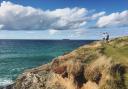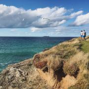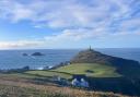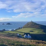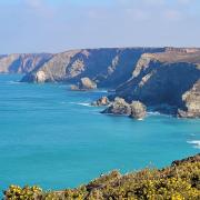

Head to one of Cornwall’s most famous harbours in St Ives for a walk to St Michael’s Mount taking in a slice of Cornwall’s history and its beauty as you go
1. Start: Follow the signed footpath from St Ives long stay car park past the Guildhall to the harbour. From the church, follow the signs east to Porthminster Beach. Follow the path to the far end of the beach and uphill. Turn left over the railway bridge. Keep right when the path divides. Continue on the path past the Baulking House, a huer’s lookout from where fishermen were alerted to incoming shoals.
2. 2.2km/ 1 1/2 miles: Turn right onto St Michael’s Way. Turn right on to the road. Turn left and immediately left after the Cornish Arms on to Steeple Lane. Stay on the lane as it curves left and uphill.
3. 3.3km/2 miles: Turn left onto the footpath opposite Ash Tree Cottage. Stay on a south-south east course past three waymarks.
4. 3.8km/ 2 1/2 miles: Turn right up a stony track, continue past Vorvas Vean. Turn left continue on the lane as it turns sharp left.
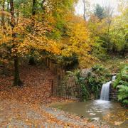
5. 5.4km/3 1/2 miles: Turn right over a stile as signed. Continue across the next lane. Note the standing stone on your left. The Path continues to Bowl Rock, said to have been bowled here from Trencrom Hill by one of the giants who inhabited it. Cross the road and continue uphill as signed.
6. 7.1km/ 4 1/2 miles: Turn right onto lane. Only 100m ahead, turn left. Follow path right, then uphill to the summit of Trencrom Hill. Follow the path downhill to the car park.
7. 8km/5 miles: Turn right onto the lane. Bear left at a fork and right at cottages. The well-signed path continues via fields past Trembethow and on across a sunken lane.
8. 10.3km/6 1/2 miles: Reaching a lane, turn right. Cross a footbridge and turn sharp left at a lane junction. Only 100m beyond Boskenna, cross a stile. Continue across fields aiming for Ludgvan church. The path crosses a stream and continues to a lane. Turn left, then right 100m ahead. Follow the path downhill and on to the village.
9. 12.7km/ 8 miles: Turn left past the White Hart. Turn first right for ‘Marazion’. Cross a lane. At a second lane, turn right. Cross the main road. Continue to a second busy road.
10. 14.6km/ 9 1/4 miles: Continue ahead across marsh via duckboards, over the railway and through a nature reserve. At the far end of the reserve, turn left, then right. Follow Green Lane, then the sea wall to Marazion Square. Take the bus back to the start.
Information:
Distance: 16.6km/10 1/1 miles
Time: 6 hours
Exertion: Challenging
If you enjoyed this article you might want to take a look at our hotlist of Cornish pub walks.