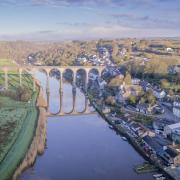


We have 10 copies of A Walking Guide to the Cornish Mining World Heritage Site to give away. The book features a series of walks designed to inspire, inform and entertain as you walk around Cornwall’s famous Mining World Heritage Site. Here we whet your appetite with one of their walks

We have 10 copies of A Walking Guide to the Cornish Mining World Heritage Site to give away. The book features a series of walks designed to inspire, inform and entertain as you walk around Cornwall’s famous Mining World Heritage Site. Here we whet your appetite with our pick.

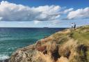
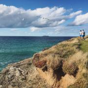
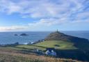
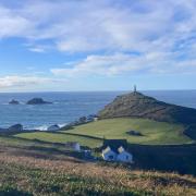
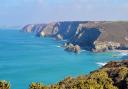
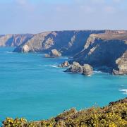
In the first of their walks we begin at the National Trust car park at Cape Cornwall. You will find access to the coast path opposite the entrance to the car park; turn right and follow the path towards and then alongside Kenidjack Valley. This secluded, wooded valley once contained eight mines and the small stream powered many water wheels. At the lower end of the valley are the remains of Wheal Call with its massive granite water wheel pit. Keep left where the path forks and go across the stream. Go left after the bridge and then right, still following the coast path and follow the signs to Botallack. Kenidjack Castle sits on the headland, an Iron Age hillfort of which not much remains except earth ramparts. As you follow the path you will see, on the cliffs to the north, two of the most impressively sited engine houses. These are the Crowns engine houses of the Botallack mine. The lower one was built in 1835 to pump water from the mine and the higher one around 1860 to haul men and ore. The mines here extended about 400m out to sea with the deepest shaft reaching down around 500m.
As you continue on the coast path you will pass a number of historic mine workings. The large concrete floors are the remains of tin dressing floors; some date from the early and mid 19th century while the latest were built in 1906 when the mine was reopened. It was essential to separate the ore from unwanted rock before it could be sold for smelting and a combination of water and gravity was used to collect the heavier tin ore. Traditionally women workers known as ‘bal maidens’ took on this job, breaking up the mined rock and sorting and sieving until the fine, black ore was separated.
Just past these old workings take the coast path to the right, signed ‘Levant’ and follow the path past the car park and the Count House, which is now run by the National Trust and has a free exhibition and information centre. The Count House was the administrative centre for the mine as well as the residence of the mine’s captain. It was built in 1861/2 and hosted lavish annual dinners for shareholders.
Walk down the path past Manor Farm and turn right at the road junction. Just before the end of this road turn right down a public bridleway; follow it round to the right and then it curves round to the left. Go right at the top of the path (by mine buildings) and keep straight on over three stiles down into Kenidjack Valley. Turn left when you reach the road and walk up to the top (the B3306 at Nancherrow). Turn right over the stream, cross the B3306 and take the footpath on the left by the ‘St Just’ sign. Follow this across the fields, over a number of stiles to the church at St Just.
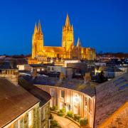
This little town was once the mining capital of the area, its little terraced granite cottages typical of mining centres all over Cornwall. The other side of the charming town square from the church is Plain-an-Gwarry, an open air theatre used for miracle plays in medieval times. To one side of the arena is a large granite block with many holes drilled in it; a legacy of hand drilling competitions between miners.
Walk across the square to the main car park; go down past the fire station and turn left at the bottom. Go past the Methodist church and the recreation ground and turn right at a cul-de-sac sign; turn right where a stony track begins. Follow the path down into the valley and turn right by the stream (by YHA sign). At the bottom where the path meets the road, turn left along the road and keep going to the sea at Porth Nanven.
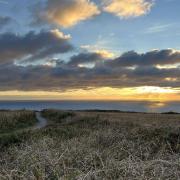
Porth Nanven is an important Site of Special Scientific Interest (SSSI); in the cliff are the remains of a raised beach, rounded boulders, work by the sea and deposited at a time (around 120,000 years ago) when the sea level was much higher. Above this is a layer of much more angular rocks, deposited by the meltwater streams when the last Ice Age came to an end. You will need to walk back along the valley to rejoin the coast path which is on the left by a parking space. You can now follow this all the way back to Cape Cornwall.
There is one last point of interest on the way, the chambered tomb known as Ballowall Barrow. This is a Scillonian Bronze Age burial barrow, named after similar tombs spread across the Scilly Isles. Ballowall is one of the largest and most complex of the many Bronze Age funeral monuments in the Penwith district.
Finally, either at the beginning or end of the walk you should go down to the beach at Preiest’s Cove to have a look at the contact between the granite and the slates into which it was emplaced.
What to see:
Botallack Count House – spectacular cliff-edge mine workings
Built during the 1860s at the height of the Cornish mining boom, the Count House at Botallack stands on the cliffs near the Crown’s section of the mine. It was the hub of the day-to-day running of the mine and also where the mine workers collected their pay. Find our more about the stories and sights of the St Just area or come along to a community event.
Levant Mine and Beam Engine – the mine beneath the sea
In its dramatic clifftop setting Levant was, for 110 years, ‘the queen of Cornwall’s submarine mines’. Today, the surviving buildings and other remains offer a window on another world, where men and women toiled to extract the riches of the earth from beneath the crashing waves.
Geevor Tin Mine – more than a mine, more than a museum
Located in Pendeen on the dramatic Cornish coastline, Geevor Tin Mine is one of the largest preserved mine sites in the country. Also a Scheduled Monument, the two acres of buildings house Geevor’s historic collections, and informative guides bring the story of Cornwall’s rich industrial heritage of life.