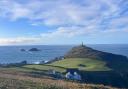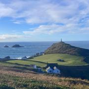

Head inland and upwards on Bodmin Moor with Robert Hesketh for an exhilarating walk taking in Cornwall’s two highest tors...

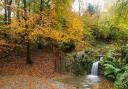
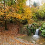
This stimulating there-and-back moorland walk includes Cornwall’s two highest tors, Brown Willy (420m/1378ft) and Rough Tor (400m/1313ft). Benign in summer sunshine, Bodmin Moor bears a wild and brooding character under louring winter skies – not least among the granite piles on Rough Tor, where Daphne du Maurier’s novel Jamaica Inn reaches its dramatic and violent climax. The views from here and the summit of Brown Willy are superb and ample compensation for the rough and rocky footing on this route, which can be very wet in parts.
Brown Willy has kept its anglicised name after local people objected to high-minded attempts to revert to the more Celtic (and less suggestive) Bronn Wenilli. Brown Willy’s cairn (man-made rock pile) is one of several en route. It has not been excavated, but research suggests Bodmin Moor’s cairns date from the early Bronze Age, circa 2000BC, and are part of the area’s remarkably rich prehistoric landscape. This includes a Bronze Age field system overlain with straighter medieval enclosures, just south-east of Rough Tor and best seen from the summit.
Rough Tor is a fitting place for the bronze memorial to soldiers of the Wessex Division who gave their lives liberating Europe in 1944/45. It is also the best point to study the Logan stone, which is finely balanced on larger granite slabs beneath and will rock back and forth under pressure. Like the prominent horizontal and vertical jointing in the granite, it is the result of natural weathering from wind, rain and particularly the freezing and thawing of ice, which splits rock as it expands. Quarrymen well knew this property of ice and used it to split blocks of granite in winter.
Jamaica Inn lies a stone’s throw from the start and finish of this walk and provides welcome refreshments. Made famous by Daphne du Maurier’s eponymous novel and the subsequent Hitchcock film with Charles Laughton and Maureen O’Hara, not to mention TV adaptations, the inn is a listed 18th century building. It has an interesting smuggling museum, which also houses du Maurier memorabilia.

Boots on Let’s Go
1. Start Park carefully outside Bolventor church, which lies on the opposite side of the A30 from Jamaica Inn. Walk back up the lane. Ignore the first footpath on your left (which may well be hidden by brambles), but take the second. Cross the field and follow the waymarks. At the foot of the slope turn left to a stile, and take the track into Dairywell Hill Farm. Walk up the track to the right of the farm, through two gates and uphill.
2. 1.2km/ ¾ mile Reaching the open moor bear right to the cairn on top of Tolborough Tor (348m/1148ft).
3. 1.5km/1 mile Head north-west, avoiding wet ground. Brown Willy suddenly comes into view. Continue north-west, joining a faint but broad grassy track which leads to a gate in the corner. Go through and turn left, keeping the wire fence on your left. Mostly, this path runs between the fence and a hedge, but when it narrows you can walk along the top of the hedge, till it broadens again.
4. 3.9km/2 ½ miles Turn left over a stile. Follow the path ahead over rough ground and then steeply uphill to the cairn and triangulation pillar on summit of Brown Willy. Either retrace your steps now or, if time and energy allow for the full route, follow the directions below to Rough Tor and Showery Tor, which will lengthen your walk by 5.4km (3 ½ miles).
5. 4.8km/3 miles Follow the path north and downhill to a stile. Continue left and downhill on the path to a stile and a bridge over the De Lank River. Walk uphill to the brass memorial on the summit of Rough Tor.
6. 6.6km/4 ¼ miles Turn north. Continue via Little Rough Tor to the rocks on Showery Tor.
7. 7.4km/4 ¾ miles Retrace your steps via Rough Tor and Brown Willy to the start.
Fact file:
Start/parking: Park with care on lane opposite Jamaica Inn SX183769
Terrain: Paths, tracks and open moor. Parts may be wet underfoot. Route best avoided after heavy rain. Two steep ascents/descents. Walking boots, map and compass essential.
Distance: 9.4km (5 ¾ miles) or 14.8km (9 ¼ miles)
Time: 3 hours or 4 ¾ hours
Exertion: Moderate for shorter version; challenging for long version
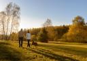
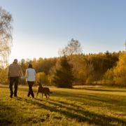
Child/dog friendly: Suitable for dogs on leads and energetic older children.
Maps: Ordnance Survey Explorer 109 ; Landrangers 200 and 201
Refreshments: Jamaica Inn, 01566 862250
Public Toilets: None
Public Transport: 211 Launceston/Truro, limited service, 0871 2002233
More Walks: Shortish Walks Bodmin Moor, Paul White, Bossiney Books, 2016.